Day 139: Stevens Pass (2465) to Lake Janus (2474)
Day 140: 2474 to White Pass (2503)
Day 141: 2503 to Milk Creek (2526)
Day 142: 2526 to Miners Creek (2550)
Day 143: 2550 to Stehekin (2572)
Day 144: 2572 to Six Mile Camp (2584)
Day 145: 2584 to Rainy Pass/Mazama (2592)
Day 146: 2592 to Harts Pass (2622)
Day 147: 2622 to Castle Pass (2649)
Final Day: 2649 to Northern Terminus (2653) and Manning Park Lodge (2661)
Highlights: Finishing!; Beautiful glaciated and glacially-carved landscapes; Fall colors and berries; Longer nights = great sleep; True sense of solitude and separation from society; Snow makes everything more beautiful.
Lowlights: Fog, rain, and snow; Feeling time pressure to finish due to approaching winter; Noticeably shorter daylight hours.
Stevens Pass to Stehekin
After spending a couple hours in the Stevens Pass lodge finishing my previous blog post, I got to the trail around 3:30 pm on Day 139. As is typical, the weather was cold and rainy, but I was powered on by the motivation of being in the final third of Washington.
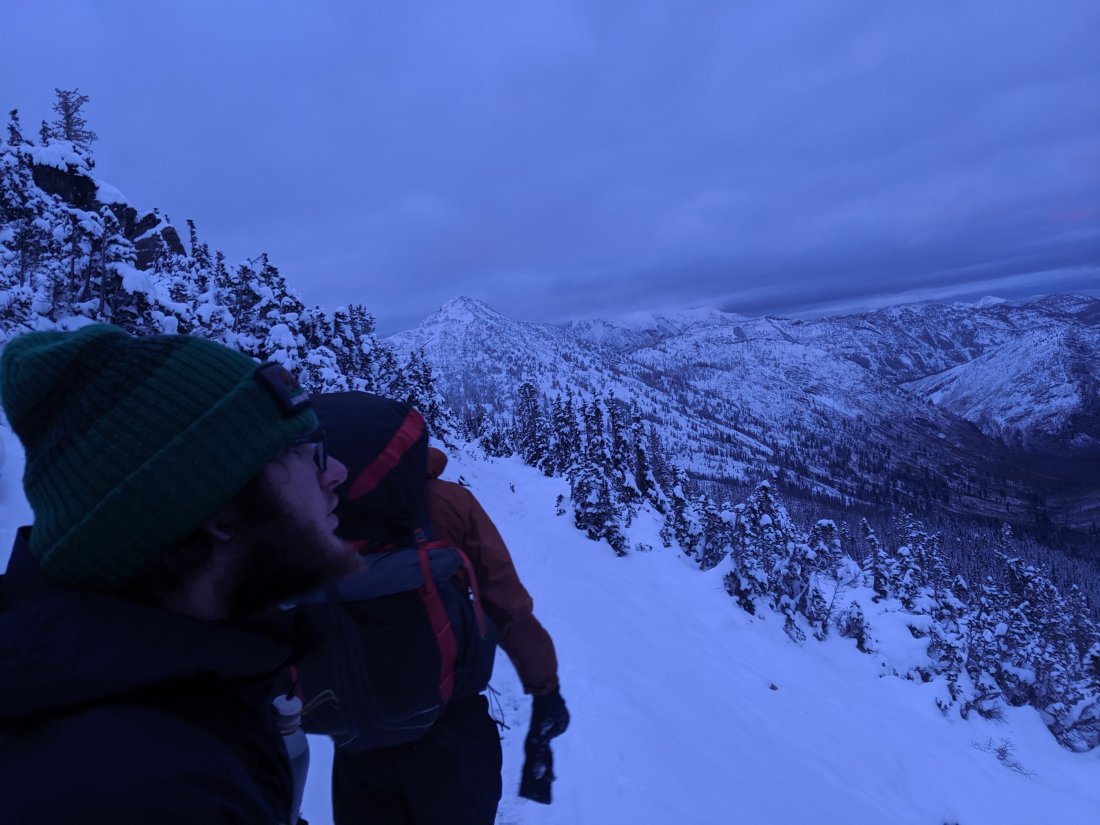
The trail between Stevens and Stehekin is some of the gnarliest trail north of the High Sierra, which made it challenging to do 25-mile days (in contrast to the comfortable 30-mile days I was doing in Oregon). While the southern and central Cascades are generally defined by large volcanos surrounded by mild non-volcanic lowlands, the non-volcanic portions of the North Cascades are jagged ridges with 3-4k ft glacially-carved U-shaped valleys in between. Consequently, the trail in this section includes several massive descents into and ascents out of these valleys, which is a challenge on the legs. Making matters more difficult, about two days of this stretch included lots of blown-down trees, each of which could be time-consuming and/or hazardous to pass over, under, or around. The presence of my guitar protruding a few inches above my head made this more difficult.
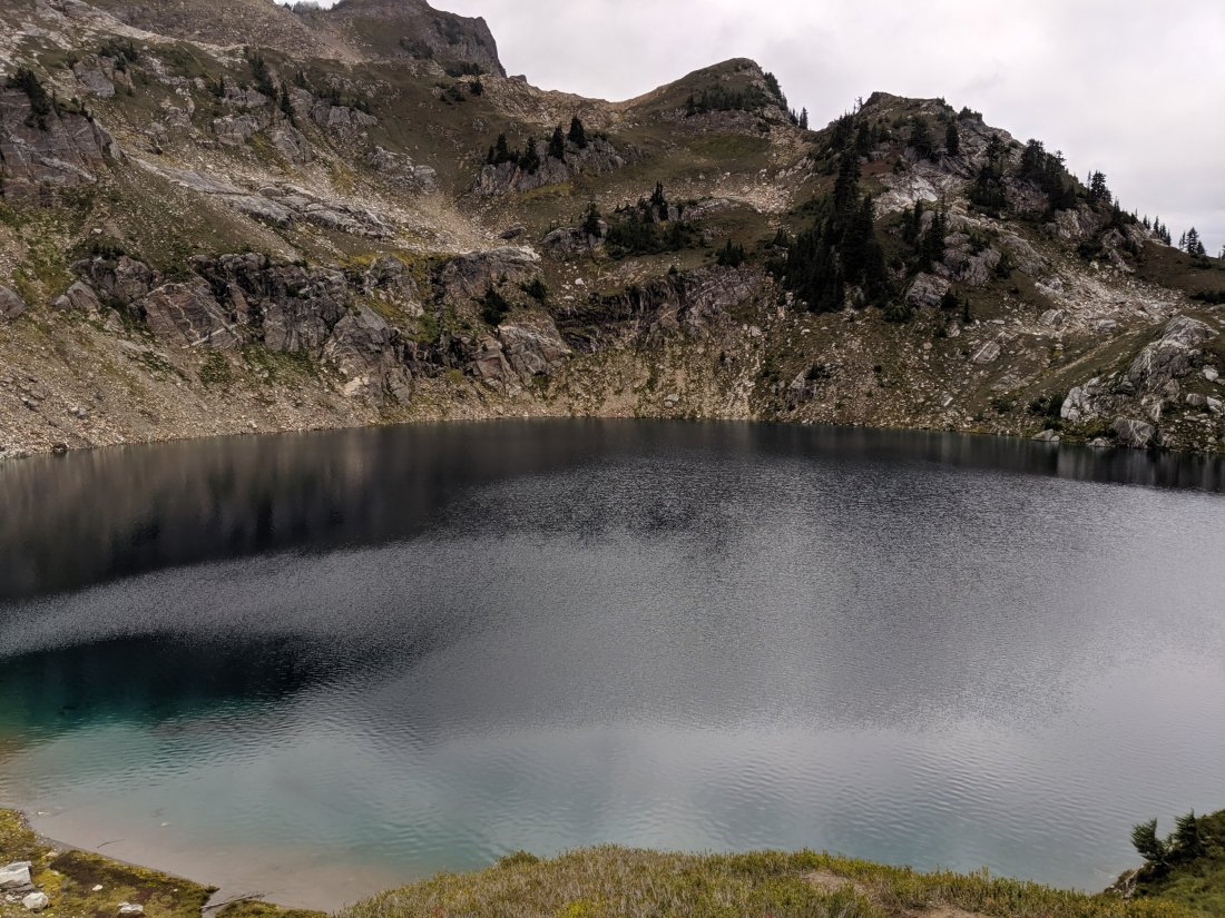
On the plus side, when the weather cooperated, the scenery was splendid. The valleys are your prototypical Pacific Northwest vibe: lots of lush old growth forests, ferns, lichens, damp bridges, waterfalls, etc.

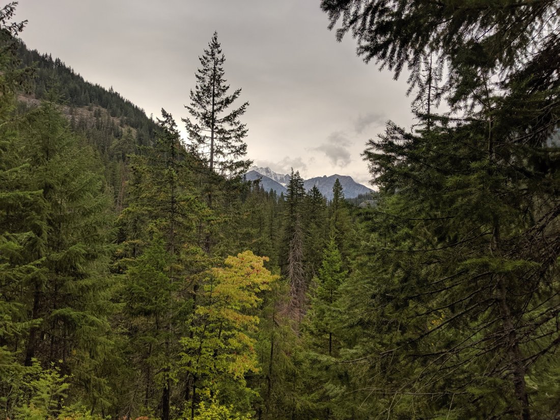


To the contrary, the ridges were generally above the trees, allowing me to see the unpopulated valleys extend for many miles in the distance, and feel a true sense of isolation from society I hadn’t felt since the High Sierra. And for the only time on the trail (probably in my whole life??), I went an entire day without seeing another human being, adding to the sense that I had this place all to myself. I feel like most people will never experience a day without seeing another person, so I feel pretty fortunate to have had that solitude without trying to solo-paddleboard the Atlantic or something.

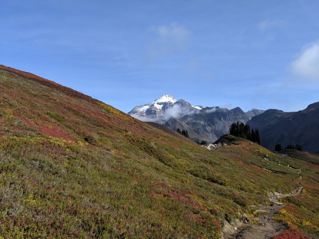


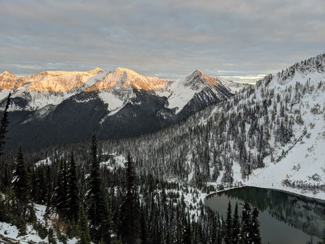
It is firmly autumnal here in Washington. Above the forest line, the hills are red-orange with the leaves of bushes I cannot identify, and deep red with the leaves of some type of delicious wild blueberry or huckleberry (which slow the pace somewhat). While it is beautiful, the changing colors, daylight, and weather (got a bit of snow on Day 143) is a constant reminder of the approaching winter and the fact that I’m still walking closer to a country known for its winter sports prowess. At the time of writing this paragraph (in Stehekin), it looks like the weather is going to cooperate long enough for me to make it through, but it’s still constantly on my mind.

Stehekin
I arrived to the village of Stehekin in the evening of Day 143, ate dinner in the restaurant, and celebrated the 62nd birthday of a woman in a group I met on the shuttle bus between the trail and town.
I had to pick up a food package at the post office, but arrived to late on Friday, and the post office doesn’t open until noon on Saturday. This meant that I had an enforced morning break in Stehekin, and what a blessing that was, as this is one of the most unique places I’ve stopped on the trail (I’m sorry, I feel like I’ve said that a lot before, but I can’t help it that I keep passing through such incredible places).
With approximately 85 residents (and many more visitors), Stehekin sits on the western edge of Lake Chelan, a very long (55 miles) but quite narrow (no more than 1.5 miles) lake that fills a glacial valley. The high mountains surrounding the turquoise lake evokes Norwegian fjordlands, but what really makes Stehekin special is that it’s totally disconnected from the outside road network. The only ways in are by ferry from the east side of the lake (the most common way, taking 3-4 hours), by propeller plane (now landing on an airstrip rather than the lake itself), or by foot (as I arrived). There are roads and vehicles in the Stehekin Valley (including the shuttle bus to town), but these are all shipped in by barge and mostly never leave (given the duration of the ferry journey, I imagine the barge journey must take an entire day).


This isolation from the rest of the world, along with the dramatic landscape, gives the region a sureal sense of timelessness, that the happenings of the rest of the world simply are not relevant here. A commenter on the PCT trail app described the post office as being out of a Wes Anderson movie, and it is (in the upstairs window, three older women are currently knitting scarves, and the man behind the counter sports long grey hair and beard, and an eye patch), but I think that description applies to the whole town. Much like, say, the Grand Budapest Hotel, things are just a little bit off in all the best ways.


Unlike the average PCT hiker (let alone non-hikers), I had actually heard of Stehekin before arriving here: my park ranger friend Marissa used to work in North Cascades National Park and lived in Stehekin (or at least that was the closest town). Several people I spoke to who work in town or in the park service remember her from a few years ago, so that was cool.
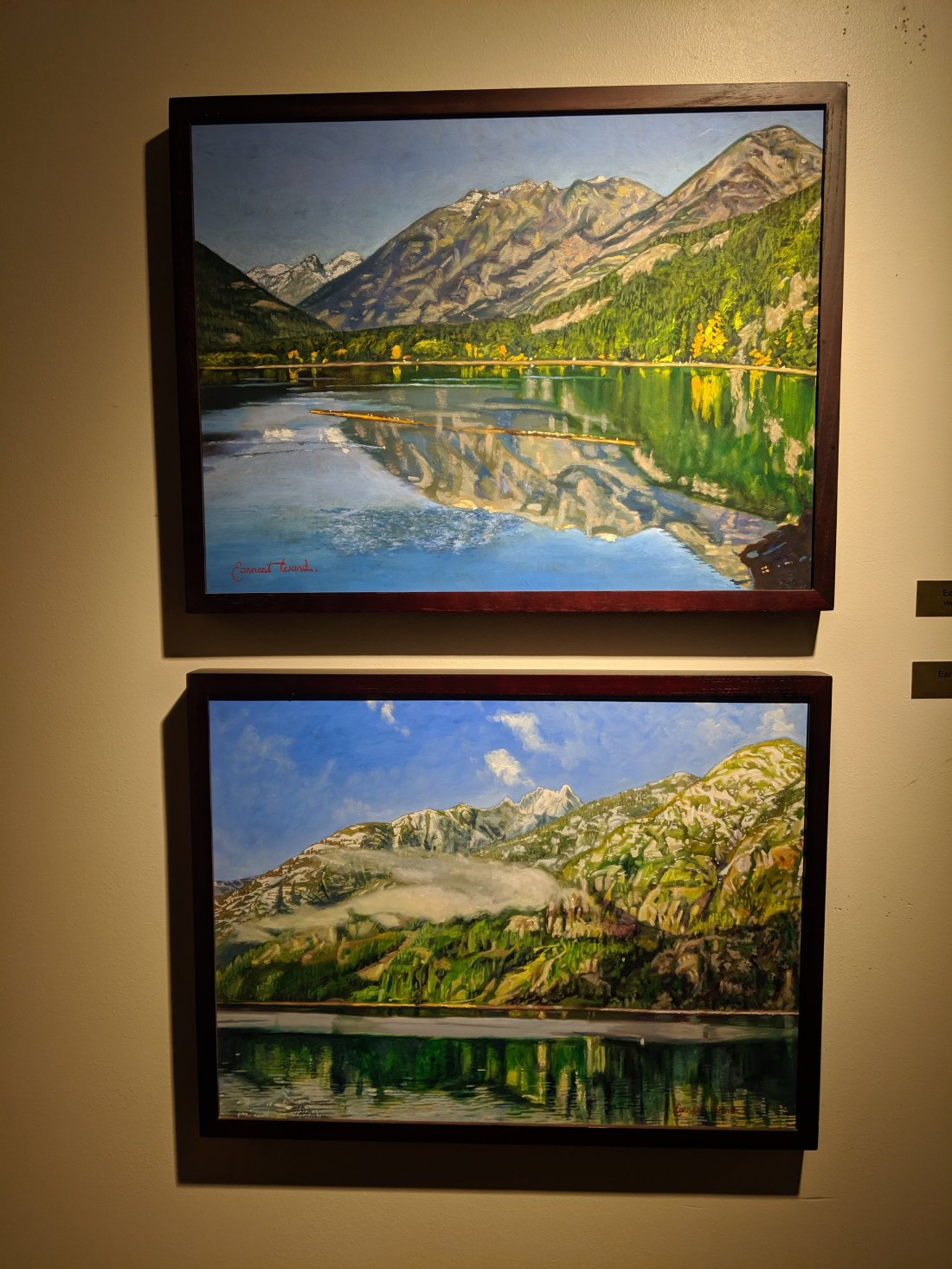
The visitors’ center in town featured art created by several locals and itinerant residents, providing a different perspective on how other people have perceived this spot.
Anyway, the list is getting long, but this is definitely a place I want to return to at some point, hopefully with better weather, and maybe stage some ascents of the nearby peaks.
Stehekin to The End
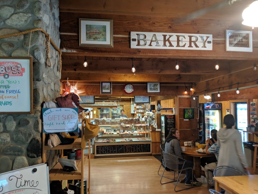
After a stop at the renowned bakery on my way out of town, I made it back to the trail by 3pm on Day 144, and pushed 11 miles to a campsite by nightfall.
Apparently, Days 143-145 were a big snowstorm, but the trail near Stehekin is pretty much all below 4,000 feet or so, so I didn’t notice much until I ascended up and out of the Stehekin River drainage on Day 145. As I approached Rainy Pass, snow began to accumulate on the trail (lower down, there was snow on plants, but it didn’t stick on the ground).


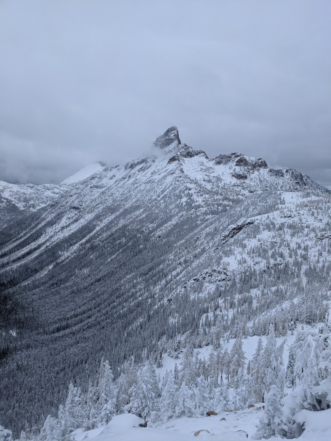
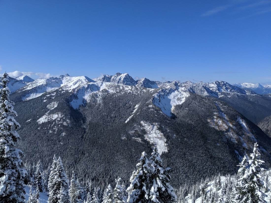
At this point, I think it would be useful to quickly summarize the geography between Rainy Pass and the Canadian border. Rainy Pass is 61 trail miles south of Canada, and is the northernmost highway crossing of the trail (and, not coincidentally, the northernmost road crossing of the Cascades in the United States). Rainy Pass is at about 4,500 feet. 30 trail miles to the north lies Harts Pass, at about 6,000 feet. Harts Pass has a campground accessed from the east by a dirt road. This is the northernmost road access to the PCT in the United States, but it’s kind of out of the way and not on a through route, so rides are harder to come by if they aren’t pre-arranged. The nearest road in Canada is 8 miles north of the border, so the effective distance from Harts Pass to the end is 39 miles (if entry into Canada is arranged) or 62 miles (if the hiker reaches the border but then has to turn back to Harts Pass). North of Rainy Pass, the trail is almost exclusively above 5,000 feet, peaking at 7,100 feet (just a couple dozen feet lower than the Washington high point in Goat Rocks). The mountains are quite rugged here as well, which is of course beautiful, but they command quite a bit of respect/fear as a result.
At Rainy Pass, winter storm warnings were posted warning of the risks posed over the weekend. I was alone, and I knew the trail continued ascending after the pass, so I decided to bail out on the road rather than push on into an intensifying snowstorm.
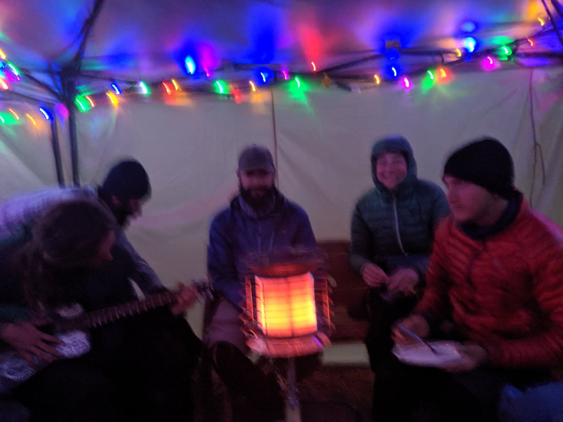
Within minutes, I got a ride in the covered bed of a pickup truck. The three folks in the cab had been up cross-country skiing nearby (not a great omen for hiking conditions) and decided to swing by the PCT crossing to see if any hikers were doing exactly what I was doing. Turns out one of them is the proprietor of a “hiker hut” in the town of Mazama, 20 miles to the east, where a dozen or so other hikers had bailed to from Rainy and Harts Passes. Four people who arrived after me had actually hiked north from Rainy Pass for 5-6 miles before turning back due to untracked knee-deep snow, so I immediately knew I’d made the right decision and was grateful to have not wasted so much effort in making it. I chilled in Mazama for the rest of the day, eating at the local bourgeois grocery store, chatting to other hikers, and watching movies.

The weather broke the next morning, and all the hikers scrambled to get out to make the most of the weather window, expected to be 3-4 days. The majority were headed to Harts Pass, just 31 miles shy of the border (not including additional miles required to reach a road). One woman had bailed from Rainy Pass but decided to get back on at Harts Pass (thereby skipping the 30 miles in between), because she was nervous about being able to make it all the way from Rainy Pass to the end before more snow came. Of course, I had bailed from Rainy Pass also, and hadn’t skipped any section of trail yet (and didn’t plan to), so her plans made me slightly second-guess my own, especially given the roughly 3:1 ratio of hikers going to Harts relative to Rainy.
Ultimately, and actually with hardly any doubt in my mind, I decided to go back to Rainy Pass and attempt to complete the whole trail without skipping anything. I knew the distance to the end was very achievable in three days in normal conditions, but the reports of deep snow did put a lot of doubt in my mind as to how many miles I could do in a day. On the other hand, I felt quite confident that I could at least make it to Harts Pass safely in that time, and could bail again from there if I had to (possibly until another year if winter had begun in earnest). For me, crossing the Canadian border without having walked the full distance would have felt fairly empty, so I decided to just keep on going from where I had bailed and see where I could get to.
The hiking was indeed challenging once I finished ascending – a few people were ahead of me breaking trail, but for the most part, the trail was covered in knee-deep snow with defined boot prints. In spite of the conditions, I had the fire that one gets when Mother Nature threatens to derail a five-month quest right at the end, and I didn’t drop too much below 3 miles per hour. I eventually caught up to a couple other hikers who were planning to push all the way to Harts Pass in a single day (remember, my backup plan was to get to Harts in three days and bail from there if necessary). We hiked fast and took basically no breaks, and so arrived at Harts Pass by 9 or 10 pm. Having been quite nervous just that morning that my opportunity to complete the hike might have already passed, I was very excited to have made it nearly half of the total remaining distance in a single day. The ground was covered in snow and it was quite cold out, so the three of us spread out our mats in the public pit toilet bathroom. Not my proudest moment, but it was better than being alone in a freezing tent.


The next morning (Day 147), the two other hikers decided they were going to push 40 miles to the border and to the lodge/road in Canada. They briefly tried to convince me to join, but I was steadfast in my refusal: this is an adventure of a lifetime, and I didn’t want to conclude it in such a hectic manner (and also cross the border monument in the dark). Instead, I still did quite a big day for the conditions (27 miles), but stopped 3-4 miles shy of the border, so I could take my time with the experience the next (and final) day.
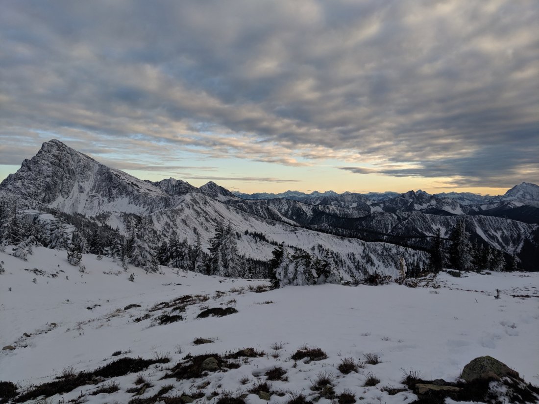
The weather was bright and sunny on Day 147, really lighting up the snow-covered jagged mountainsides. This area is clearly beautiful without snow, but I generally think that a layer of fresh snow adds another layer of beauty and tranquility to most landscapes, so it was awesome to see such beauty (not to mention that it was awesome to see anything at all, since I wasn’t walking through a cloud like I have been for the better part of three weeks).


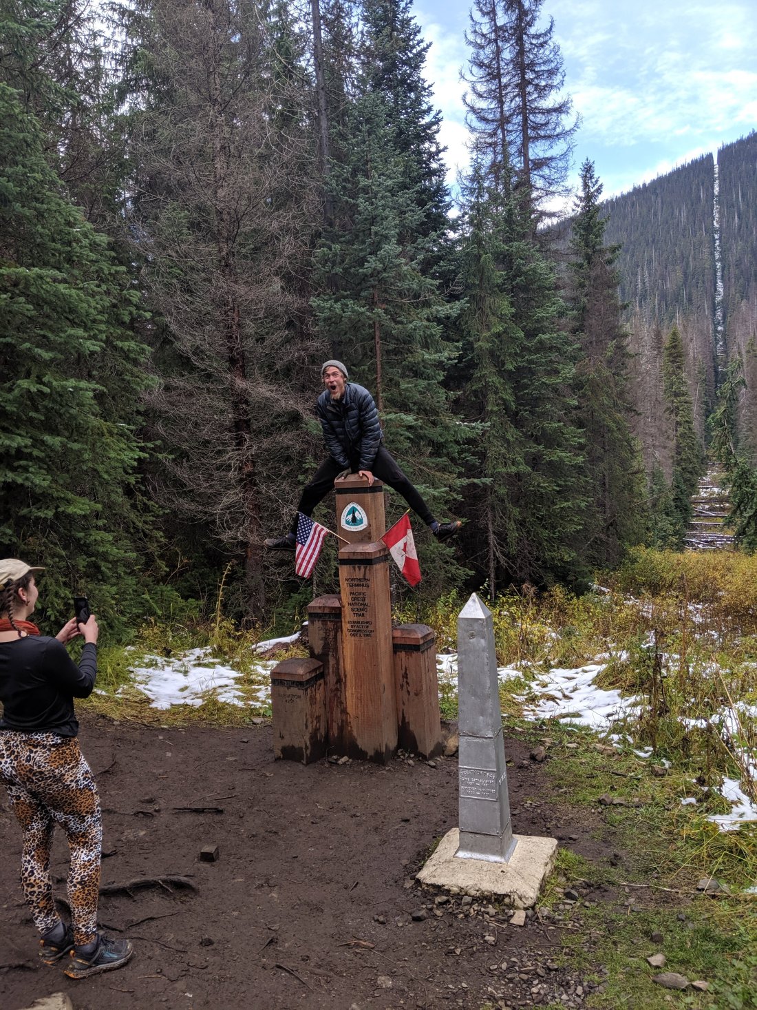
I woke up pretty early the next morning and hiked the final four miles to the US-Canada border, arriving at around 9, and staying for about an hour. There were maybe 8-9 other hikers present during the hour, most of whom actually needed to hike all the way back to Harts Pass before the next snow storm. I had been worried that I would get to the terminus alone and have no one to celebrate with, but I think the narrow weather window condensed everyone a bit, so actually it all felt pretty populous.


The mood was jubilant and reverent. Lots of shouting, laughter, tears of joy, some weightier tears (not necessarily of sadness, but of the emotional weight of completing such a major undertaking). A couple of guys there had hiked together from the beginning through thick and thin, and the joy they shared together was so pure that I had to get some candid pictures of their emotions together.

I finally finished my American Pie recordings, to be edited together in the next couple of weeks. In the entire last five months, I avoided ever playing the final two measures of the song, even if I was giving an otherwise-complete performance of it, to save the end of the song for end of the hike. To finally put the final two bars on the end was an awesome way to cap the hike, and I think the jubilation will be clear in the video when I finish putting it together.
After an hour at the Terminus, I hiked another three hours to Manning Park Lodge, in British Columbia, had a lunch of a salmon burger, poutine, and a Molson, and got a ride to Vancouver from the friend of a hiker. I am now in Vancouver for another day before flying back to San Francisco tomorrow, and to London in about a week and a half.
And so that’s it for my grand journey! I’m very proud to have completed it, and very relieved that I was able to snake my way through the dodgy weather at the end without skipping any sections of it. I’m still a long way from home and I’ve been off the trail for less long than some of my breaks while I was on the trail, so the reality of this no longer being my life hasn’t really set in yet. This blog is not yet over: I’ll definitely write some post-trail reflections in the coming days and weeks when I’ve processed it. Plus, I have to report my post-hike body measurements.
For now though, the main thing that sticks with me is how much time seemed to slow and how eternal it all felt, in a very good way. I think back to standing on the Southern Terminus, or the tranquil beauty of Mt San Jacinto covered in snow, or hiking all night across the LA aqueduct, or sleeping in the hut atop Muir Pass in the High Sierra, or the god-awful treeless volcanic section north of Lassen, or the cobalt beauty of Crater Lake, or hiking 68 miles in 26 hours in Central Oregon, or crossing the Columbia River at the Bridge of the Gods, and it all feels like it took an entire lifetime to achieve. And yet it was all in the last five months. It will never be possible again, even if I were to do a second thru-hike, but I wish I could make every five months feel like a lifetime. Life is short; make it count.
So that’s all I have to say from the trail (or from this couch in Vancouver). Now time to start reintegrating into society, which will probably be harder than anything I’ve done in the last five months.
Happy trails!

Congratulations Soren! It’s been fun following your journey the last five months. It’s been inspiring to witness from the comfort of a computer screen, forced me to find new ways to stretch myself beyond work and the screen, and I’m so in awe of your accomplishment.
I still chuckle at the randomness of seeing you at a Starbucks in Santa Barbara on your way to begin the journey. Hope your last couple of weeks on this continent is incredible and best wishes as you get back into the swing of life back home!
LikeLike
It’s been a joy to follow your incredible journey. Looking forward to seeing that video!
LikeLike
Incredible.
LikeLike
CONGRATS!!!!!!!!!!!!!!! I saw the email that you’d titled “done” and I couldn’t believe it was over. Can’t wait until you post the video 🙂
LikeLike