The five sections of the PCT, part 1: Desert and Sierra

Minor housekeeping: Start date is now looking pretty set on Wednesday 8 May. If you’re in San Diego on the 7th, I’d love to grab a last meal with you.

As I’ve mentioned in an earlier post, the PCT runs the height of California, Oregon, and Washington. Living in Europe (the UK is and always will be part of Europe, no matter what anyone says), a lot of people I speak to think that California is just beautiful beaches and don’t really know anything about Oregon or Washington.

The reality of the PCT is very different: I’m fairly certain that the ocean is never visible from the trail (maybe on an exceptionally clear day with no smog you could see over the Los Angeles basin?), and you’re in some form of mountainous region for the vast majority of it, even when you’re in the desert. Anyway, I thought I’d describe the route of the PCT in a bit more detail, with a section on each of the five sections the trail is typically split into: the Desert, the Sierra, Northern California, Oregon, and Washington. I’ve covered the first two below, and will talk about the other three in a subsequent post.

I’ve spent varying amounts of time in each of these places (mostly in Northern California), but my descriptions are largely based on stuff that I’ve read rather than firsthand experience, and none of the photos are my own (yet).

I’ve posted this map before, but it’s useful here, so keep it handy:


Section 1: The Desert (702 miles)

Beginning: Mile 0 – Campo (Mexican Border), CA Section A
End: Mile 702 – Kennedy Meadows, in CA Section G
Stokedest about: Finally being on the trail, interesting scenery that I don’t know so well, the occasional visit with SoCal friends.
Scaredest about: Heat, water, getting into the routine of just walking every day.

The first 700ish miles of the PCT are categorized as the desert. While the word “desert” conjures images of Wile E. Coyote and tumbleweeds drifting along a deserted highway, this section is actually quite mountainous, traversing most of the major Southern California mountain ranges (from the south: Laguna, San Jacinto, San Bernardino, San Gabriel, and Tehachapi mountains).

While the section is characterized by heat and dry stretches, especially in the lower portions, it also has some of the most dramatic changes in elevation, dropping up to 9,000 feet at a time into low passes occupied by major interstate freeways (8, 10, 15) and large scale wind farms. The biggest of these is from the top of Mt San Jacinto* at 10,600 feet down to San Gorgonio Pass at 1,200 feet (where I-10 connects Riverside/San Bernardino to Palm Springs and the Coachella Valley), over just 25 trail miles.

*Technically the PCT doesn’t go to the top of San Jacinto, but it’s a very popular alternate route.

Apparently the inspiration for Mt Chiliad in GTA: San Andreas. Goodbye, knees.

Beyond just finally being out there, I’m excited to see something a little different. Most of the hiking I’ve done has been in pretty alpine, forested areas (or cold and damp UK), so the desert scenery should be a nice change.

Another big upside of this section, beyond being situated in a pretty novel ecosystem for me, is that it has by far the best access to civilization, with the outlying towns of the greater SoCal urban conglomeration never more than a few days apart, and with pretty reliable phone service. Later on in the trail, I think this would be a drawback, but I think I’ll appreciate having the logistical training wheels on at the beginning of the trail.

The section is also supposed to have quite a lot of exciting fauna, like rattlesnakes that think that trails are pretty well-designed for basking, and scorpions that think that shoes are pretty well-designed for sleeping.
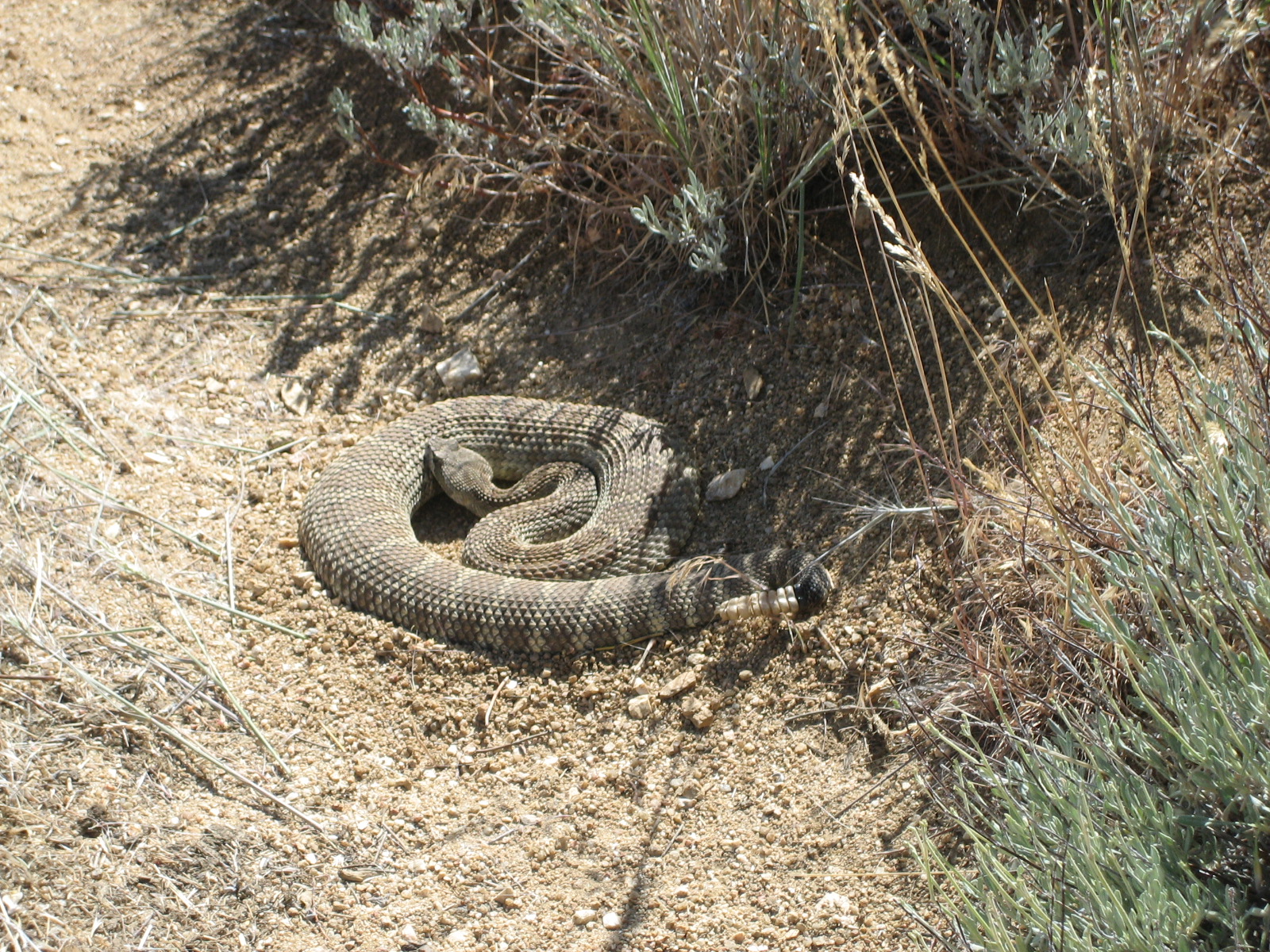
Eyes on the ground, always. (p.c. The Hiking Tree Blog)

In the lower elevations, heat (90s F/30s C) and water are a concern, so I’ll try to avoid hiking in the middle of the day, opting instead for getting an early start, taking a siesta from 12-4, then hiking into the evening. In the worst sections (like crossing the floor of the Mojave desert), I may go completely nocturnal. I’ll also need to load up on up to 8 liters of water for the longest dry sections, which adds 8 kg (thanks, metric!) or 17.6 lbs (boo on you, imperial) to my backpack.

The section ends as it rises into the southern extremeties of the Sierra Nevada mountains. The traditional end is a place called Kennedy Meadows, a tiny little town with a general store where hikers tend to swap out their gear for more mountain-specific gear.

Section 2: The Sierra (317 miles)

Beginning: Mile 702 – Kennedy Meadows, in CA Section G
End: Mile 1,018.5 – Sonora Pass, end of CA Section I
Stokedest about: BEARS! Also, HUGE mountains, HUGE views, true wilderness, and plenty of water.
Scaredest about: Carrying lots of additional weight (more food, snow gear, bear cannister), stream crossings.

The second, and most popular, section of the trail is the Sierra Nevada mountains, known to PCT hikers as simply The Sierra. I have a slight quibble with the nomenclature, on the basis that the Sierra Nevada continue about another 200 trail miles to the north of Sonora Pass (which is well south of Lake Tahoe – unambiguously in the Sierras), but I understand that these 317 miles of trail have a lot in common in terms of the hiking, with high passes, snowy conditions, and a general sense of wilderness.

This is the highest and most rugged section of the trail. When non-Americans balk at the concept of mountains in California, I generally tell them two facts: (1) The 1960 Winter Olympics were hosted by Squaw Valley, CA (this is less impressive now, since apparently Beijing is worthy of hosting winter olympics); (2) the highest point in the contiguous (i.e. no Alaska or Hawai’i) United States is not in Colorado, but in California (granted, numbers 2-4 and 7-17 are in Colorado). Said peak, Mt Whitney, stands at 14,505 ft/ 4,421m above sea level, and is a short side hike off the main PCT.
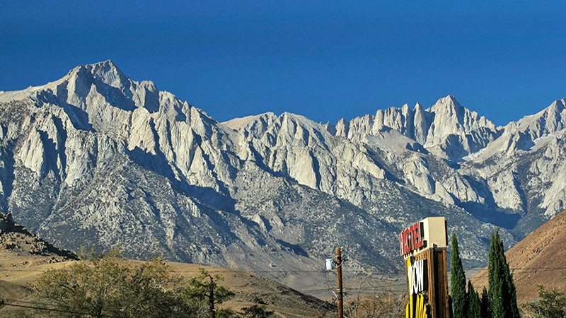
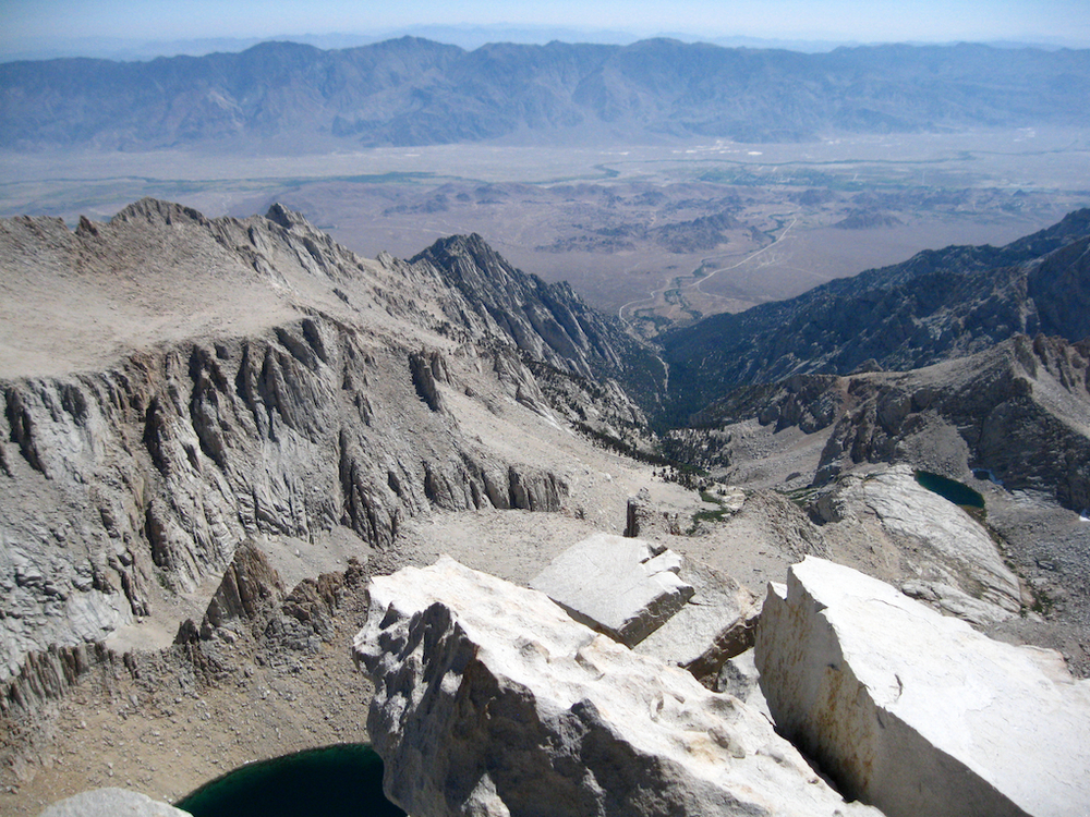
The Sierra (Mt Whitney on the right) from the Owens Valley far below and to the east

And approximately the opposite view: The Owens Valley from the summit of Whitney

This section of trail is by far the most remote: the distance from Kennedy Meadows to the next reliable re-supply that doesn’t require a substantial detour is about 180 trail miles. Those that push through that stretch will go 9-10 days without crossing a road or even seeing a power line. Most hikers will instead take one of a few side trails down into the Owens Valley, and then have to hike back up into the Sierras. The former approach sounds pretty appealing, but I’ll make up my mind on that later.

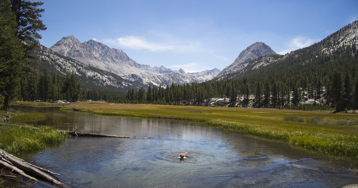
This section of trail stays almost exclusively (maybe entirely?) above 10,000 feet, and crosses several high alpine passes, including the highest section of the official PCT at Forester Pass. The scenery is pretty grand up there (though I haven’t seen it with my own eyes). Here are some pictures I’ve scoured online, but looking forward to replicating (probably not the Ansel Adams one…).

Kearsarge Pass & Pinnacles
Mt Williamson. p.c. Ansel Adams
Evolution Valley

In terms of big tourist destinations, this section of the trail also overlaps with almost the entirety of the John Muir Trail, named after possibly the most important person behind the creation of the national parks system in the US, and passes through the Ansel Adams wilderness. It also crosses through three national parks: (from south) Seqouia, Kings Canyon, and Yosemite (though avoiding the most famous valley portion of it).

Along with this beauty comes some definite hazards though: black bears (which are more of an adorable nuisance than a danger, and mean that you have to carry a heavy plastic bear cannister to protect your food), potentially snowy treacherous slopes (tackled with the aid of spikes and an ice axe, if necessary), and, most concerning in my opinion, stream crossings.

Due to the remote location of the trail and the severe winter conditions, there are almost no bridges across any of the myriad streams and rivers fed by the high mountain snow. Sometimes a log will conveniently straddle the creek, but in many cases, the only option is to ford the river. Those of you who have played Oregon Trail know that that’s not an ideal option, and this is especially true in June when snowmelt is at its peak and when many PCT hikers are passing through the section (the optimal time for hiking this section, if not bound by getting to Washington by October, is probably July or August, when the snowmelt has subsided). The most likely consequence of all of this (besides being cold and wet often) is that I’ll have to spend a lot of additional time looking for a slow section to swim, or waiting for a bigger group to cross with, or waiting for morning to cross (these streams will peak in the afternoon, as the sun melts snow more quickly). However, worse consequences do happen: two thru-hikers drowned in seperate stream-crossing accidents in 2017, which was an exceptionally high snow year. The snow (and creek) levels will almost certainly be a lot lower this year, but I’ll do well to remember the very real consequences of these hazards when considering whether its worth spending the additional time required to make a safe crossing.

This section ends at the next road north from Yosemite, Hwy 108, as it crosses Sonora Pass (approximately due east from Stockton, CA). At this point, I should be able to ditch my Sierra-specific gear (snow and bear-related).

Ok, I think that’s plenty of text for a single post. I’ll write up Northern California, Oregon, and Washington in another post.
A thank you, plus my planning thus far

Hi, I have some followers now (and have discovered how to make the first letter HUGE)! I don’t anticipating writing that frequently in the next four months, as I’m not quickly accumulating experiences worth writing about, but I’ll occasionally give you updates on the prep process.

I have a logo!

The keener observers will notice (assuming I’ve clicked “save” enough times in enough places) that my page now sports an awesome new logo, inspired by but not identical to the official PCT logo. In case you haven’t (or I’ve failed to properly upload it), it looks like this:

Is that a beard at the top, or an owl celebrating its victory in the ski jump (h00t!)?

This is a creation of my good friend Marisa in Portland, OR, and I can’t thank her enough for it (Thanks Meeeeza!). In return, I will spend the day of her wedding hiking through the sun-scorched Southern California desert, thinking of nothing but the pleasantly damp, cool air of hers and Derek’s event in Oregon.

Planning thus far

It’s a little presumptious to expect you to come all this way just to read about modifications to my nascent website, so I’ll add to that and describe a bit of what’s gone into to preparing for my PCT hike up to this point, and what I expect to need to do in the coming months. Of course, without having put this to the test, I really can’t yet say whether my level of preparation is over- or underkill.

Long-term life planning

I’ve been planning to do the hike for several years now, at least as early as summer 2013, when I remember articulating the concept to my cousin Caitlin. My plan at that point was to go to grad school (which was about to start), pay off loans, save up some money, accumulate gear, and then go. I’ve now done the first 3.75 of those 5 things, so I think I’m doing alright.

It’s definitely not necessary to plan 6 years in advance, but most employers don’t love the concept of you leaving for 5-6 months, so people often fit the hike around major structural breaks in their lives: graduation, retirement, quitting a job, a big move. I’d planned for it to fit around the latter two items of the above list, and did in fact put in my notice at work, but for a couple of reasons changed my mind and agreed to an unpaid leave of absence instead (it was a rollercoaster of emotions in my office that week).

Anyway, I’m grateful that I’ve got all of that big stuff more or less in line, and glad that the rest of my life is simple enough that I can put it on hold for half a year. I can’t imagine how people with children manage it (if they do even).

Getting gear and trying it out

Over the last year and a bit, I’ve slowly accumulated most of the gear I’m going to take out with me (another post on that, I’m sure). I went up Kilimanjaro with a few friends in September 2017 and used that as an excuse to invest in some nice warm hiking clothes.

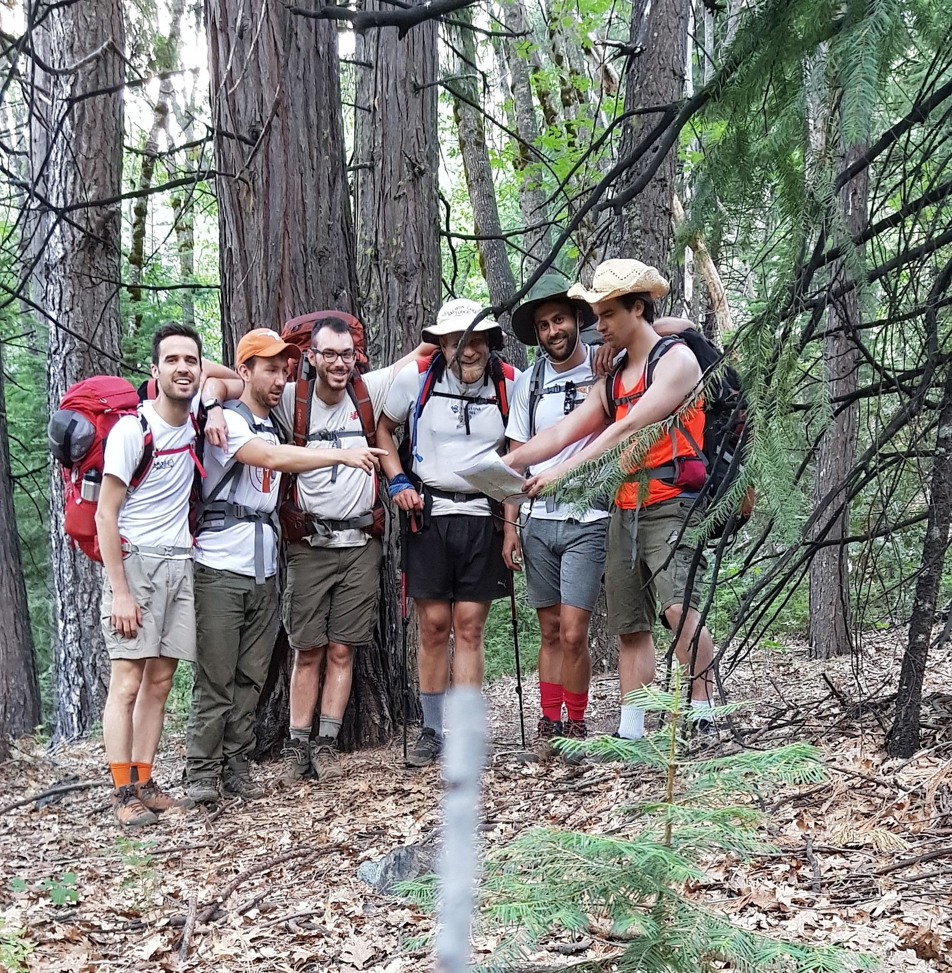
However, I’ve mostly had stuff sent to my mother’s house in California (while I live in the UK), so I haven’t had much chance to hike with it. My first (and only) big test for my gear was last summer, when I hiked for three days along the PCT with my brother and four of my friends, from Donner Pass to Upper Salmon Lake, where my extended family owns and operates a lakeside summer resort. (Pics from that hike below).

We’d be lost without David. Also pictured, and with far more interesting names (from left): Bernat, Lauri, Etienne, me, Torsten.
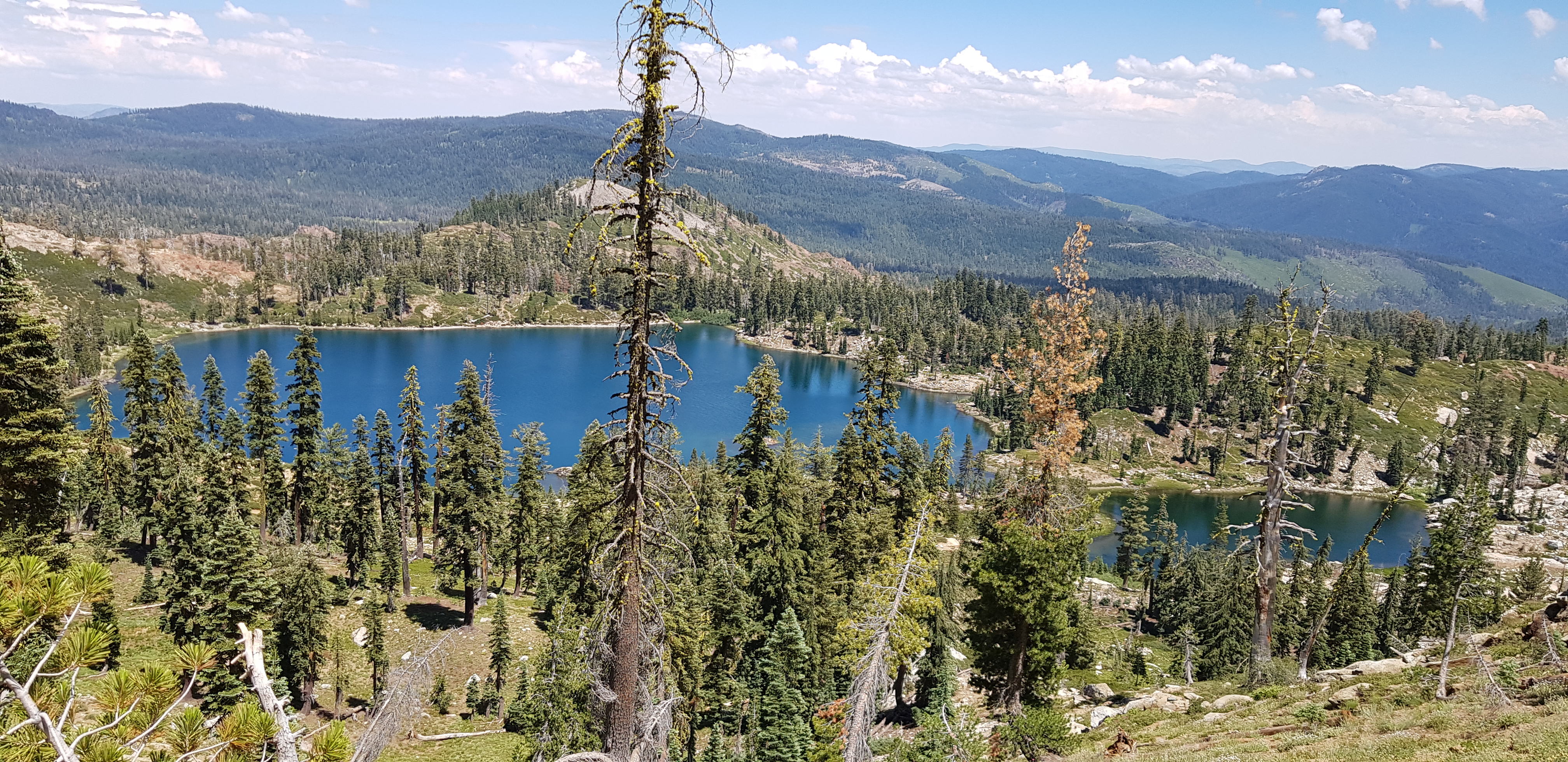
Deer Lake, very near the end
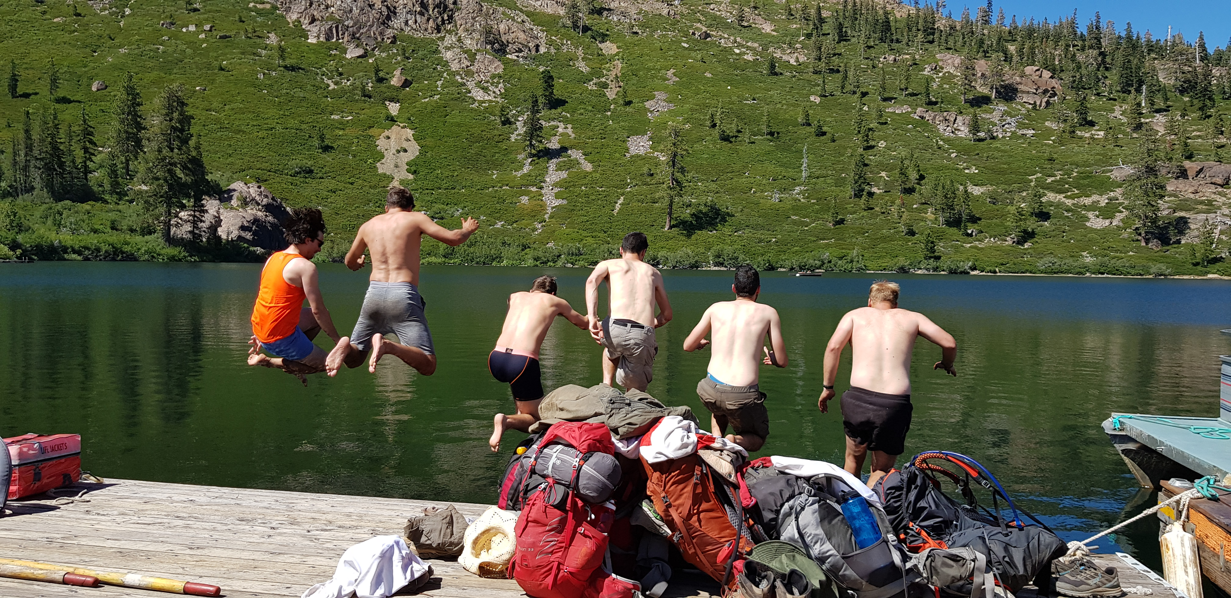
Completing the hike with a jump in the lake.

That was a grueling trek (basically PCT pace of c. 20mi/32km/0.032Mm per day, but with no chance to ramp up to it), but it was a good opportunity to see whether I liked walking that far (I did, my feet didn’t), and also an excuse to get some trail-ready gear together. In advance of that, I bought me a new backpack (the Osprey Exos 58), a new tent (the Big Agnes Copper Spur UL2 Platinum), a new sleeping pad (Neoair X-lite short), and some cooking supplies (stove, gas, pot, spork) and decided I was happy with all of them, even if their names are impossible to say or remember. At that point, my gear was probably half complete, but I’m glad I was able to get at least that much in the bag (haha) so I no longer have to stress about it.

The process of buying the right gear is, of course, time consuming. Because you don’t bring a lot with you, and because you carry every single thing you do bring, it’s very important to maximize the ratio of function to weight. Fortunately, that means that there are a whole lot of reviews and recommendations out there from other long-distance hikers.

Christmas gifts this year were very PCT-focused, so I’m now probably 80% of the way there, but haven’t tried out any of the new stuff, so I may still need to make adjustments on the fly when I get out there.

Permits

I won’t spend too much time on this because it’s really not that exciting, but these days I’m sorting out permits. The big one is the PCT long-distance permit, which is technically not required, but basically gets you out of needing other permits in national parks and wilderness areas along the way. The catch is that the PCT Association (PCTA) only releases 50 per start day (to prevent hundreds of people starting on the most popular days), and due to the increasing popularity of the trail due to the book/film Wild!, it’s now pretty tough to get a start date in April, as is preferred. (I verifiably wanted to do the trail before the film came out in 2014, and maybe before the book came out in 2012, so Reese Witherspoon can go get mauled by a bear, and Cheryl Strayed maybe can too.)

Anyway, for that reason plus constraints on my leave of absence, we’re scheduled to start on the 11th of May. I’m hoping we can move that up 3-4 days, but in any case, we’ll want to carry a pretty good pace to catch up to the ideal window.

I also have to get a permit to enter Canada via the trail. That should be straightforward – just need to scan a couple of things and email it to them.

Various relevant skills

Two big ones here:

When thru-hiking the PCT, you’ll inevitably do some snow travel in the High Sierra, and maybe also in Northern Washington. As I won’t have my skis with me, I wanted to get some training on how to hike through snow. So my friend Marissa (not the logo one, and in any case, spelled differently) and I did a winter skills training course in the Cairngorm mountains in Scotland last Easter weekend. I now know how to avoid avalanches, walk with crampons and an ice axe, kick and/or chop steps, and self arrest.

And the other thing I haven’t done yet. I’m probably going to do some sort of wilderness first aid training, as there’s a good chance that something will go wrong with somebody at some point, and it can’t hurt to be prepared.

Getting in shape!

I haven’t technically started doing this yet, and there’s a school of thought that says you should just try to pack on as much fat as you can to give you fuel later on, but I think I should strengthen my legs/cardio before I start so I can do longer distances earlier on. I’m planning to enter in a half marathon sometime in March/April, maybe in Wales. I’ve done full marathons before, but I think that verges on over-working your body so I don’t think that gives myself the best chance of completing the hike. Plus, training for a full marathon totally takes over your life of 3-4 months, and I don’t want to give up my life for that long.

After that, I might do a few days of walking into work (about 10km) with a pack on in order to strengthen my back/core. I think I’ll need to wait until it’s light that early, or else I’ll have no hope of actually doing it.

So what else do I have to do?

Not much, unless there’s something big I’m missing. I’ve got a bit more gear to buy, including a new phone; I need to sort out food for my first few days on the trail (including my first re-supply box); I need to do some visa/immigration stuff for the UK; I need to get travel insurance; I need to go to the doctor to make sure I’m not going to die on the trail. I think that’s about it, but I’m sure something else will jump out at me.

Anyway, hope you’ve enjoyed reading all of that. Any questions??

Who, What, Where, When, Why, How?

The Pacific Crest Trail is quite a well-known trail on the West Coast of the United States, and to a lesser extent elsewhere in the country, and probably most people reading this from the US have a sense of what it is and might know somebody who has “thru-hiked” (i.e. start-to-finish) the trail.

For those of you that don’t, or those who do but just want to see it in my words, let’s do a who/what/where/when/why/how of my planned trip.

Who?

If you’re reading this close to the time of writing (New Year’s Eve 2018), you’re probably a close friend or family and know full well who I am. In the off chance that this blog gets some traction beyond my closest circle, I’d better introduce myself.

My name is Søren (the ø is not optional). I’m 28 years old from Davis, CA, but I’ve lived in London, UK for the last five years. I currently work in energy economics (mostly electricity-related) for a consulting company in London, from which I’ll be taking a leave of absence this summer.

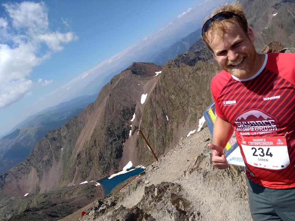
A ridiculously beautiful but painful trail race in the Pyrenees in Andorra. Apparently the ø is optional.

Aside from mountain activities (hiking, skiing, running, climbing), my other main hobby is music. I just bought a little lightweight carbon fiber guitar which I’m super stoked to bring along with me.

I’ll be joined by my friend and soon-to-be-former colleague Chris. He’s 28 years old, from Northern Virginia, and is fully quitting his job at the same consulting firm (but different team from me) and moving back to the US in the process.

I also have a few friends who are planning to join for sections in the middle, and my brother is going to start the trail with me, but I’ll leave out those intros for now.

If you’re not from California or otherwise don’t recognize the reference, my domain name is a reference to the Soarin’ Over California ride at Disneyland/California Adventures in Anaheim, CA. It was definitely a hilarious joke in high school when I went there with the band program and/or cross country team. “Look, it’s ME over California!” My back-up domain name would have been a High School Musical reference (sorenflyentheresnotastarinheaventhatwecantreach.com), so thank god that my first choice was available.

What?

It might have been easier to start with this one, but the ordering of who/what/where/when/why and sometimes how is incontrovertible.

The Pacific Crest Trail (PCT) is a long distance hiking and equestrian (horsies) trail which runs from Mexico to Canada through California, Oregon, and Washington. The southern terminus is just this side of the wall on the Mexican border (yes, there is actually quite a bit of wall that already exists), while the northern terminus is in the clearing of trees which separates the US from Canada. The nearest road access is about 10km into Canada, so in practice, people who finish the PCT at the Canadian border always go a bit further into the Great White North.

Southern Terminus. Mean barbed wire and corrugated metal in the background.
Northern Terminus. Just a bunch of happy trees.

In between the termini is about 2,650 miles, 4,300 km, or 4.3 megameters (Mm) of mountainous trail, from the (mountainous) deserts of Southern California, the high alpine Sierra Nevada in Central and (sort of) Northern California, and the temperate rainforests in the Cascade range in Oregon and Washington. The high point of the trail is Forester Pass in the High Sierra, at just over 4,000m (13,000 ft), but nearby Mt Whitney, the highest point in the lower 48 states at c. 4,500 m (14,500 ft), is a short side hike, so I understand that most people add that to their itinerary (I intend to, at least). The low point is just above sea level as the trail crosses the Columbia River between Oregon and Washington at Bridge of the Gods.

There are a bunch of other people who have written some pretty serious blogs and vlogs about the trail if you want to learn more. I particularly recommend halfwayanywhere.com, which is both highly informative and entertaining.

There are also two other similar trails elsewhere in the US. The Appalachian Trail (AT) is the oldest and most established, running from Georgia to Maine. It’s the most “civilized”, making it easier logistically, and is the shortest, but I’m told the terrain itself is the most difficult, so it’s no easier in total than the other two. The Continental Divide Trail (CDT), by contrast, is the newest, least-developed, longest, and gentlest, running from Mexico to Canada through New Mexico, Colorado, Wyoming, Idaho, and Montana (I think). The PCT seems to fit right between the AT and the CDT in all of the metrics above. Completing all three is called the “Triple Crown” of thru-hiking, and a small handful of people (including a couple of people in 2018) have managed to complete a “calendar-year triple”, which is totally insane.

Where?

I think this has been covered in the “What?” section.

When?

The average hiker takes 4-6 months to complete the trail. The record is something like 45 days, but that involves running for basically every waking hour, and having most of your stuff carried for you.

Exact dates TBD, but looking to start in early May. It’s generally best to start in mid/late April, which is hopefully: early enough to avoid heat and water scarcity in the desert (CA sections A-F/G in the map above); late enough that the High Sierra (CA section H, mainly) is clear enough from snow that it’s passable; and early enough that you make it to Canada before the snow hits again in early/mid October.

For various reasons that I don’t feel like getting into, April is not quite possible for us, so we’ll be starting in early May. Being relatively young and fit, hopefully we can soon catch up to the optimal schedule and can finish by the end of September or very early October. We shall see.

Why?

This probably deserves its own post, and maybe I’ll write that soon. The short answer is that I love being outside, I love and miss the American West, I’m feeling increasingly disconnected from the natural world, and I’ve grown up near the PCT, so it seems natural to want to link up the whole of the West in one long epic hike. This has been kicking around in my mind for probably 10 years, so I’m really excited to actually do it.

There are a lot of wider philosophical questions about why humans decide to undertake arbitrary and decidedly unproductive challenges, whether that’s running a marathon, climbing Everest, or dragging months of supplies behind you on a sled across Antarctica. If you have a couple of spare hours, I recommend this New Yorker article which explores some of these questions, and, sadly, ends in tragedy with the death of the story’s subject near the end of his quest: https://www.newyorker.com/magazine/2018/02/12/the-white-darkness

It definitely comes from a place of privilege though. I can only imagine the reaction of generations past, or of people living paycheck-to-paycheck today, to the absurdity of paying a bunch of money (the gear ain’t cheap!) and foregoing months of productive work/salary just to give up most of the hard-earned creature comforts of Western society.

How?

Left foot, right foot, repeat.

In all seriousness, though, in between resupply stops every five days or so, we will be completely self-supported. That means carrying tents and sleeping bags, a few days’ worth of food, and filtering water directly from natural sources of varying quality.

Weight is a huge concern, so people, myself included, typically invest in lightweight equipment (especially backpacks, tents, and sleeping bags, the so-called Big 3) and try not to take too many unnecessary things like spare clothes, chairs, and food high in water (you’d rather addthe water when you get to a source). I’m bringing a travel guitar, which I think will raise a lot of eyebrows amongst the seriously ultra-light hikers, but that’s a cross I’m willing to bear.

Anyway, that’s a sort of overview of the key elements of the journey. I could (and will) go into more detail in separate posts. Ideas for future topics include: gear, food/resupply, exploration of existential questions about thru-hiking, the trail culture as viewed from afar, etc. Comment below or email me if you want to hear about anything in particular!

I’ll pepper these posts in during the next 4 months before I start hiking, at which point it will move to more of a travelogue of the hike itself, I assume.

In the meantime, hit the “follow” button so you get email notifications when I post new things. Thanks for reading!

Søren over Califørnia