
Day 79: Donner Pass (1153) to Jackson Meadows (1183)
Day 80: 1183 to Salmon Lake Lodge (1210)
Days 81-82: Hanging out at Salmon Lake
Day 83: 1210 to A-Tree Spring (1220)
Day 84: 1220 to Fowler Creek (1245)
Day 85: 1245 to Spanish Peak (1271)
Day 86: 1271 to Chips Creek (1293)
Day 87: 1293 to Little Cub Spring (1316)
Day 88: 1316 to dirt road near Chester (1342)
Day 89: 1342 to edge of Lassen Volcanic National Park (1366)
Day 90: 1366 to Lost Creek (1386)
Day 91: 1386 to Burney (1411)
Highlights: Going north again; Visiting Salmon Lake; Easier hiking conditions than the High Sierra; Hiking with family; Volcanic scenery in Lassen
Lowlights: Leaving Salmon Lake; Lots of forests with limited views; Not as many other northbound hikers as I expected; Long stretch without a proper bed.
I really need to write these more frequently…
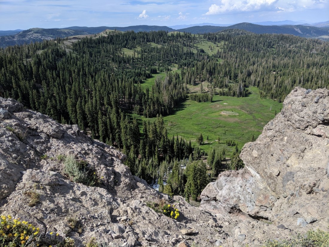
Donner Pass to Salmon Lake
After three weeks of really grinding out miles southbound to finish the Sierras, I was now finally back on track to go north to Canada. My mother had picked me up at my exit point in Kings Canyon and drove me up to Davis to sleep and run errands, and then we drove the remaining 1h45 to Donner Pass early the next morning.
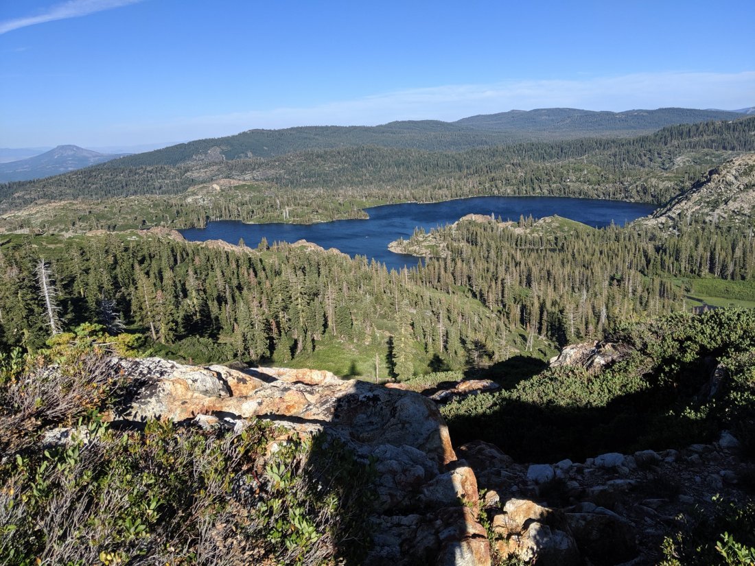
I was on the trail overlooking Donner Lake, famed campsite of the fated Donner Party, by 8:45 am. It’s 57 miles along the PCT from Donner Pass to Salmon Lake Lodge, the Christian family business since 1958, and where I’d planned to take my first days off from hiking since I flipped up to Donner Pass in early July.
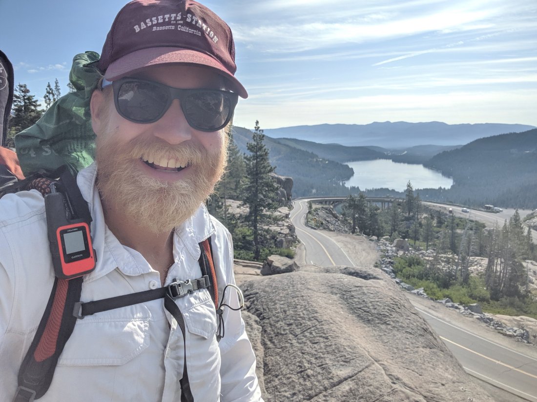
Last summer, I organized a group of friends and brother to hike from Donner Pass to Salmon Lake, and it took us most of three days. Being in great hiking condition and acclimated to 12,000 feet, I figured I could do it in two days, with the possibility of hiking through the first night and doing it in 24 hours.
I had been up late the night before running errands and doing chores, and up early that morning for the drive, so I figured the 24-hour push wasn’t in the cards this time. Indeed it was not, but I think I could do it were it not for the fatigue and the pain in my feet caused by insoles which are now basically paper-thin (I have just replaced them).
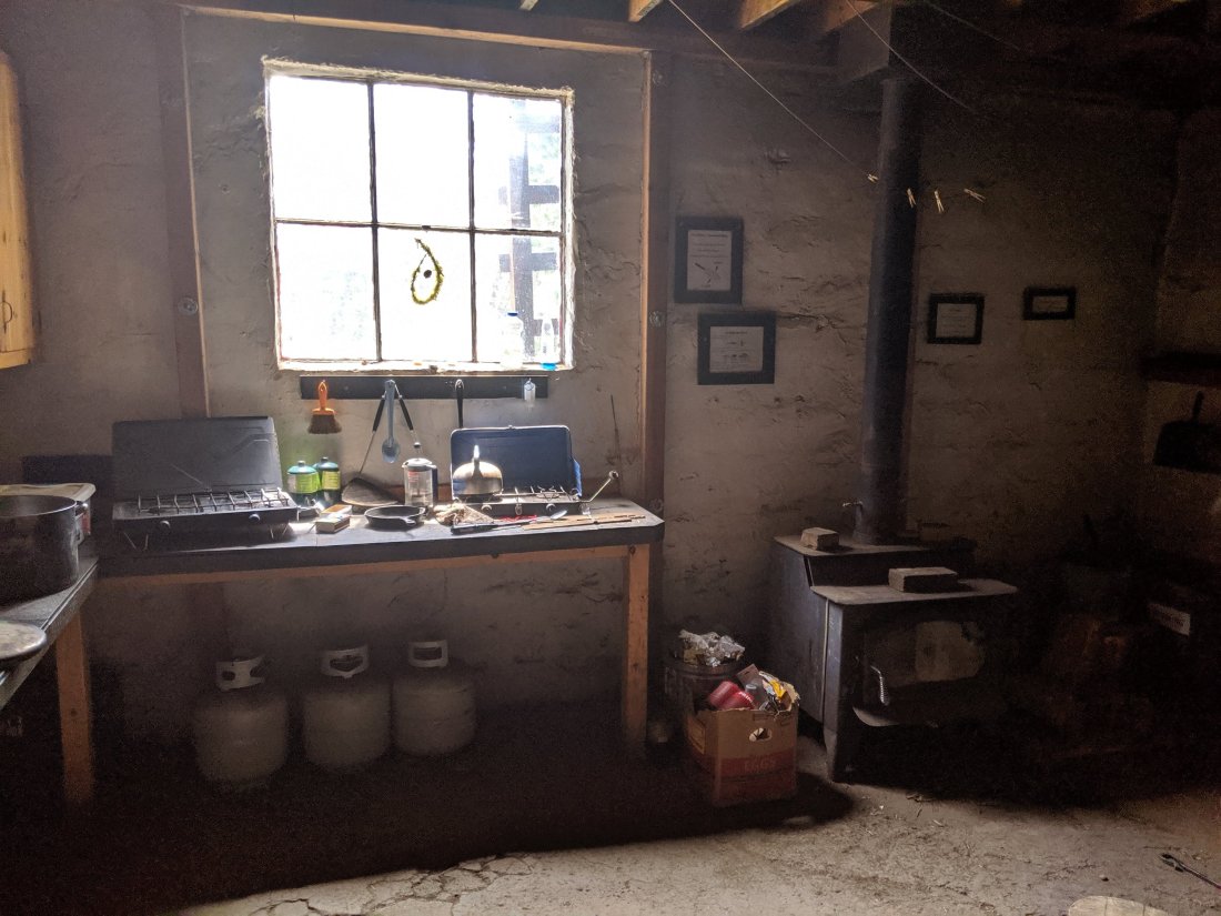
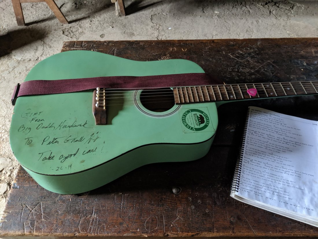
I stopped for lunch on Day 79 at the Peter Grubb Hut, an awesome little cabin in the woods with a small kitchen and common area downstairs and a loft for sleeping upstairs. It’s apparently open year round (I think reservations are required in the winter), so I would definitely recommend it for a short out-and-back weekend trip.
I pushed 30 miles that day, my first 30-mile day on the PCT (I did 30 miles from Paradise Valley to Idyllwild in Southern California, but 3 of those miles were down a side trail which I would then have to climb back up), and camped near Jackson Meadows reservoir, high up the Middle Yuba River.
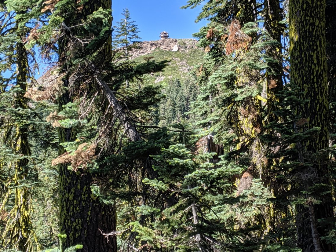
The next morning I descended into the North Yuba River near Sierra City by lunchtime, and spent the afternoon climbing the long, sunny south face of the Sierra Buttes, a challenging section made easier by the excitement of hiking in the neighborhood of Salmon Lake.

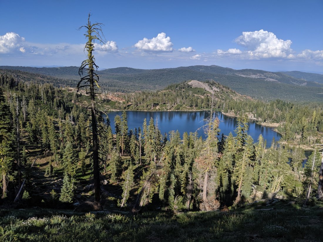
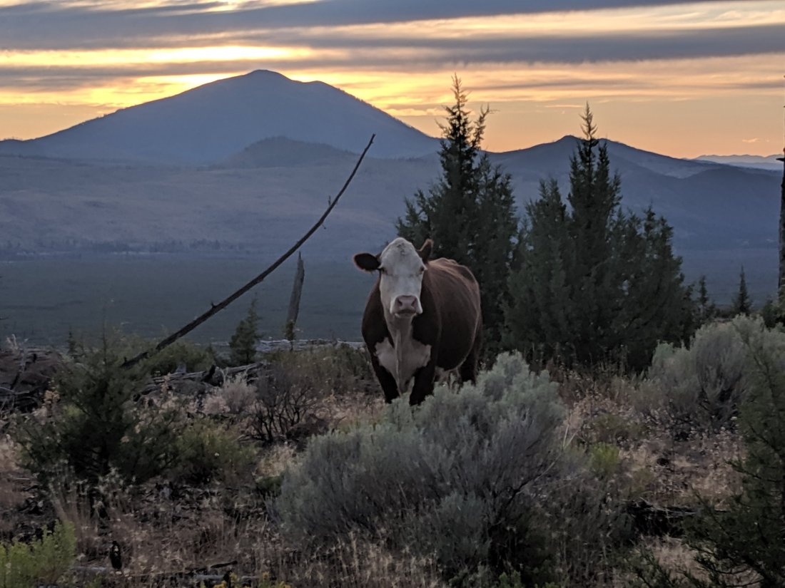
I arrived at Salmon Lake around 6:30 pm, to find my sister Katya partway up the trail greeting me with a beer. My mother and brother Torsten arrived late that night, and I spent the next two days hanging out with them and other members of my extended family (aunts Bev and Sidonie; cousins Owen, Maddie, and Maren), as well as several longtime friends of the family.
Normally when I visit Salmon Lake, I do quite a bit of hiking. Obviously that itch is being thoroughly scratched in the remainder of my life, so this time I pretty much only left the Lodge to drive boats across the lake for guests.
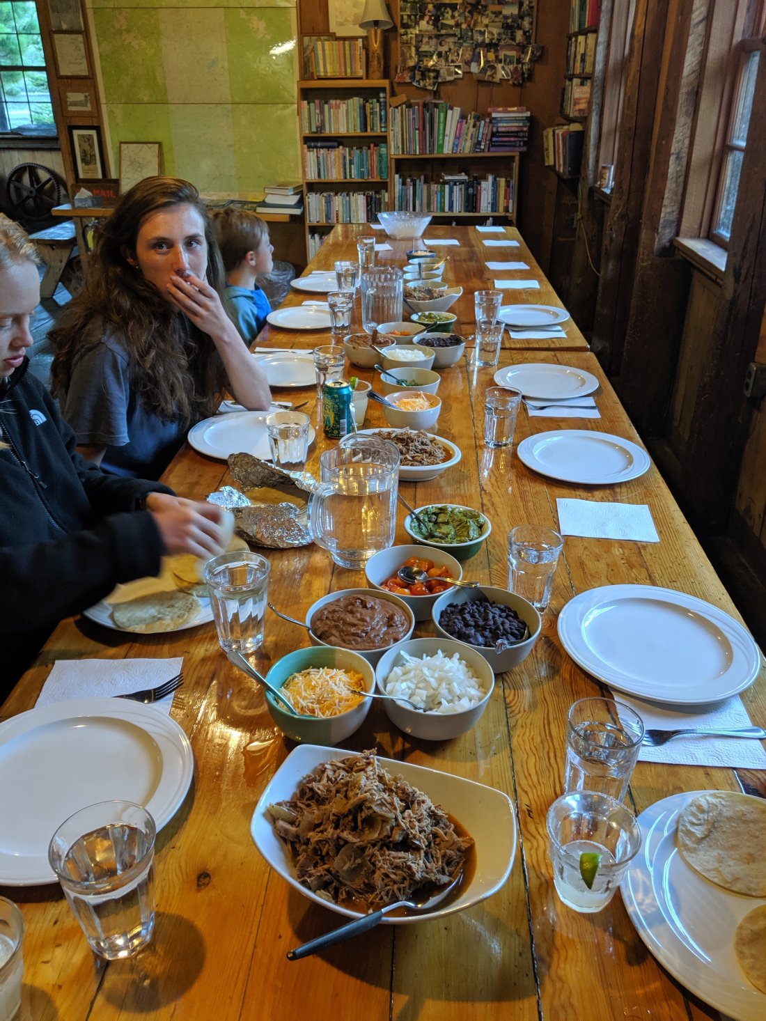
As I was planning my arrival, I remembered that I actually quite like to cook, and have been starved of the experience for quite some time now, so I gave my mother an extensive shopping list so I could get elaborate in the technically-commercial kitchen in the lodge. The first night I made carnitas tacos, complete with pulled pork cooked in a slow cooker and margaritas; the second night I made puy lentil gallettes, a recipe from Yotam Ottolenghi’s vegetarian cookbook Plenty. After three months of cooking with a single pot over a tiny propane tank, it felt really good to be able to stretch out and properly cook, and for a sizeable crowd (c. 15 each night).

I left the Lodge on the morning of Day 83 with my mother, with whom I wanted to share a piece of my experience. We made it past Gold Lake and Long Lake before cutting over towards the Lakes Basin trailhead, where we were intercepted by Katya and our friend Anya. After having lunch amongst the four of us, I then returned to the PCT to continue my northbound journey. This was definitely one of the hardest afternoons I’ve had mentally – to have been in a place that’s like a second home to me and then leave to return to the grind of hiking all day was a challenge made more difficult by the familiarity of the terrain I was still in. Fortunately, this wistfulness subsided a couple of days later, as the reminders of Salmon Lake lessened.
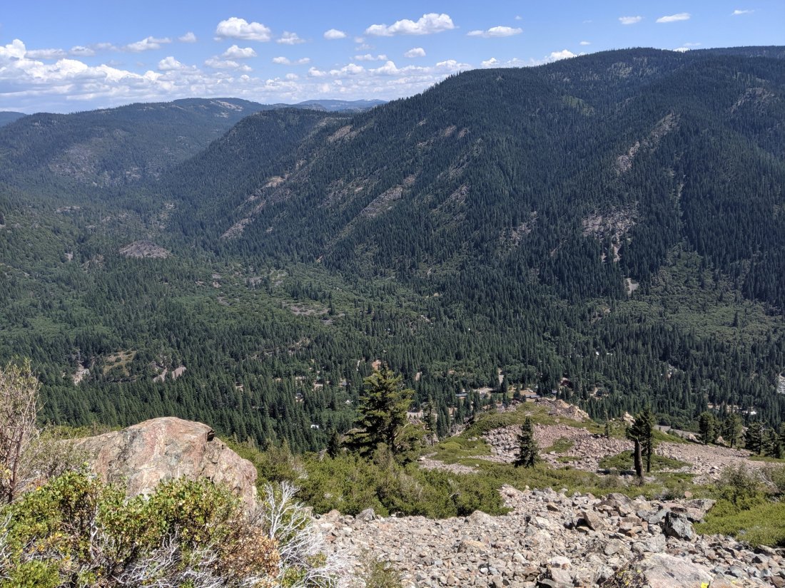
Salmon Lake to Lassen
The trail continues northwest out of the Lakes Basin region along a series of ridges and down into the canyons of the Middle and North Forks of the Feather River.
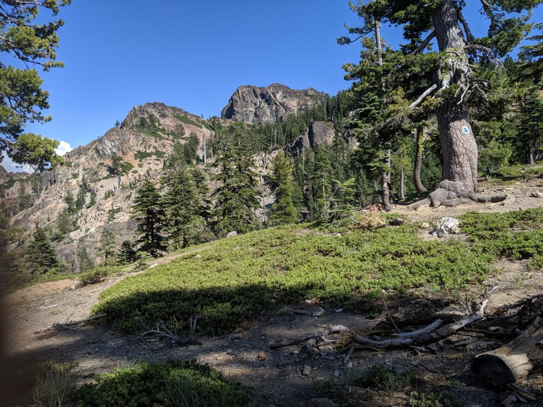
Not too much to say about the hiking for these few days: lots of forests which are interesting in their own right, but can get a bit monotonous, especially when compared to the high peaks I had left in the High Sierra.
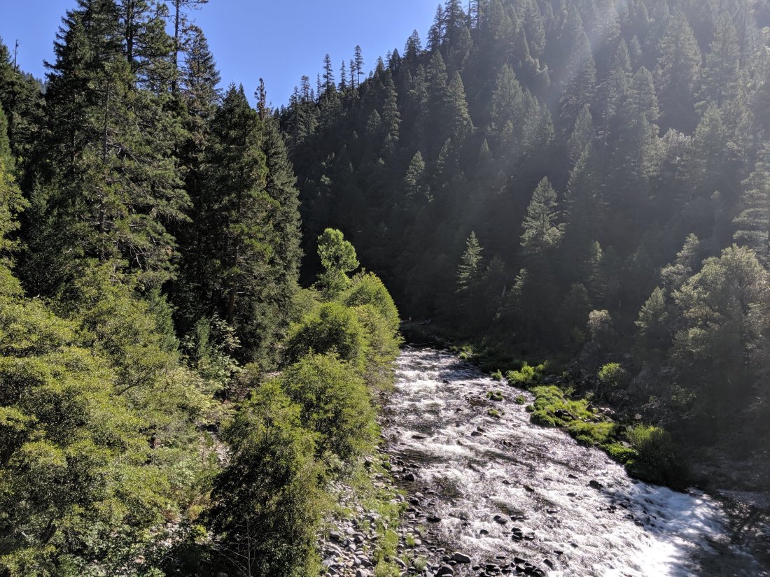
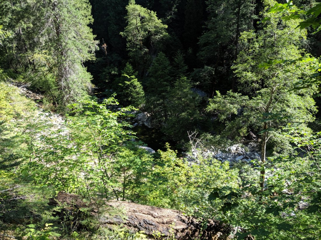
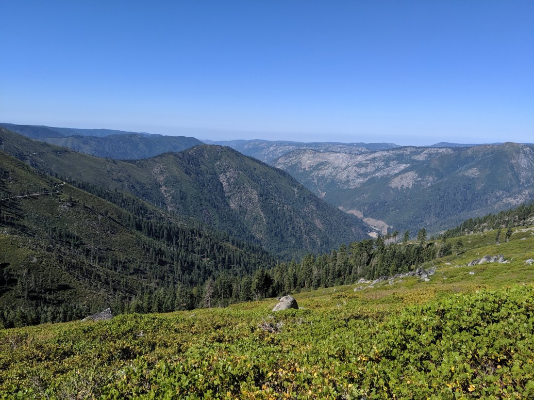
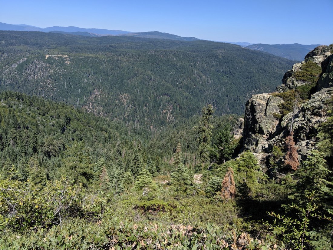
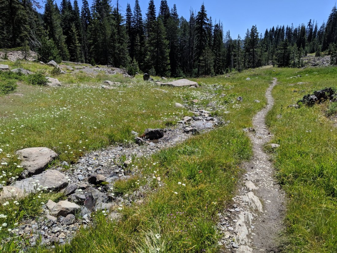
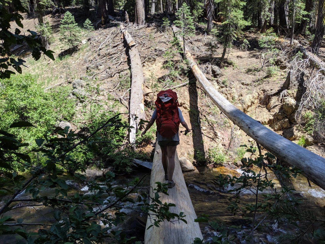
The hiking was mostly relatively easy, with the exception of two huge 4,000 ft+ descents into the forks of the Feather River and corresponding ascents out of them. The Middle Fork is a federally-designated “Wild and Scenic” river and is therefore free of most human interventions, and it is indeed very lovely. The North Fork, by contrast, is basically one big hydroelectric project, with several reservoirs between Lakes Almanor and Oroville. This hydro project was also where the Camp Fire which ravaged the town of Paradise originated (though downstream of where I hiked). I met my father for lunch in Belden, on the North Fork, and hiked up the canyon with him for an hour or two, discussing the electricity infrastructure and forests of the region.
A couple of days later, I descended off of the final Sierran ridgelines and into the lowlands around Mt Lassen.
And I also crossed the midpoint of the PCT, which was a pretty nice milestone.

Lassen Volcanic NP to Burney
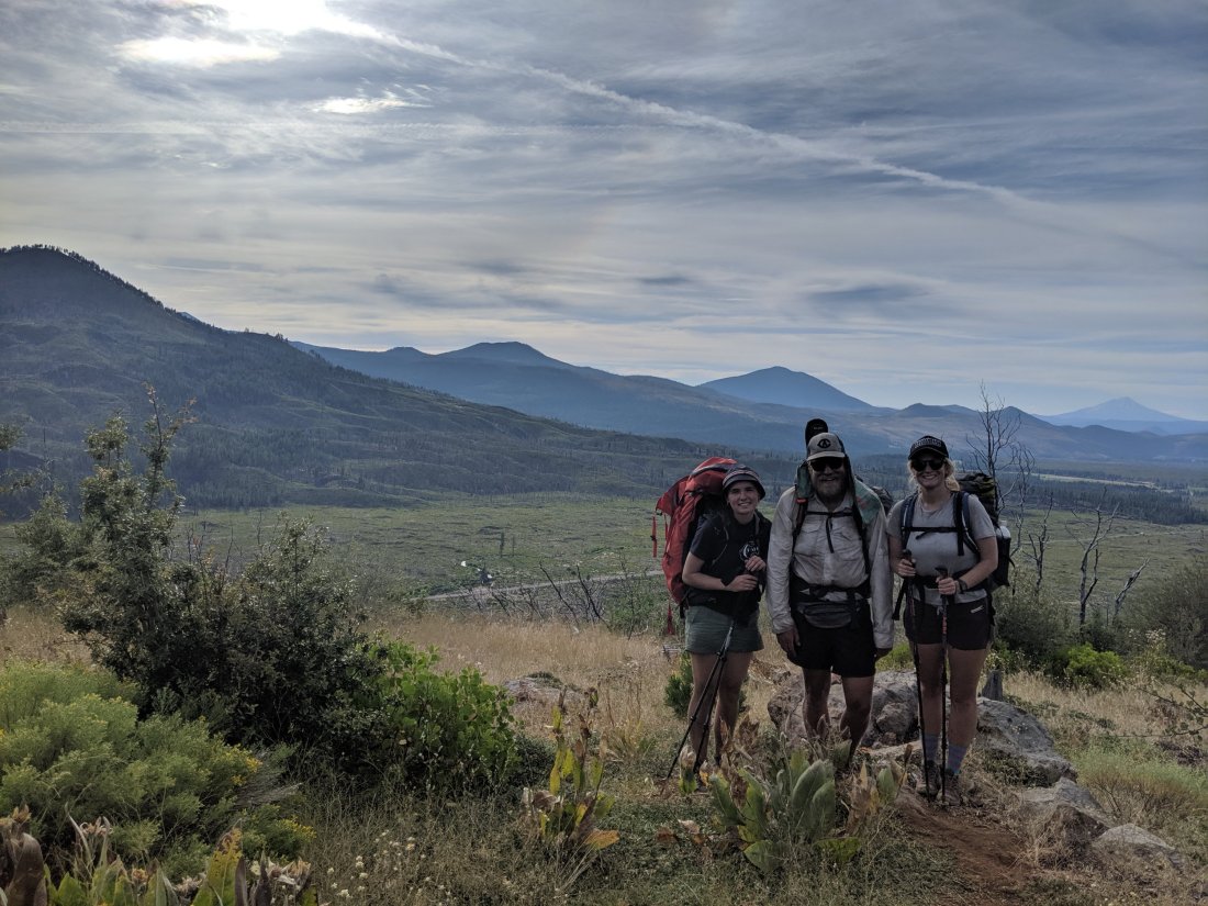
At the end of Day 88, my mother, Katya, and Anya joined me for the night, with Katya and Anya hiking with me for the next two days (and my mother driving back home the next morning after the camping experience). We camped about five miles south of where the trail crosses into Lassen Volcanic National Park, apparently the least visited national park in the country. The trail spans 19 miles of parkland, and plastic bear cannisters are required to camp in the park. Having sent mine home after the High Sierra, and with neither Katya or Anya having one, that meant having to do 24 miles in order to avoid camping in the park. By now I’m pretty comfortable with that distance, but it was an impressive and gritty effort by Katya and Anya to do so right out of the gate. We hiked a further 14 miles together the next day before arriving at their car (and I continued another six miles alone in the evening).

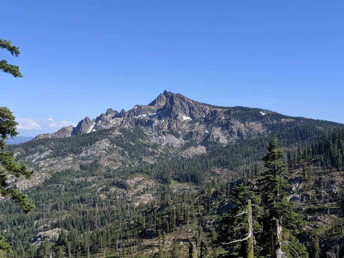
The Lassen area, both in the national park and north of it, was a real highlight.
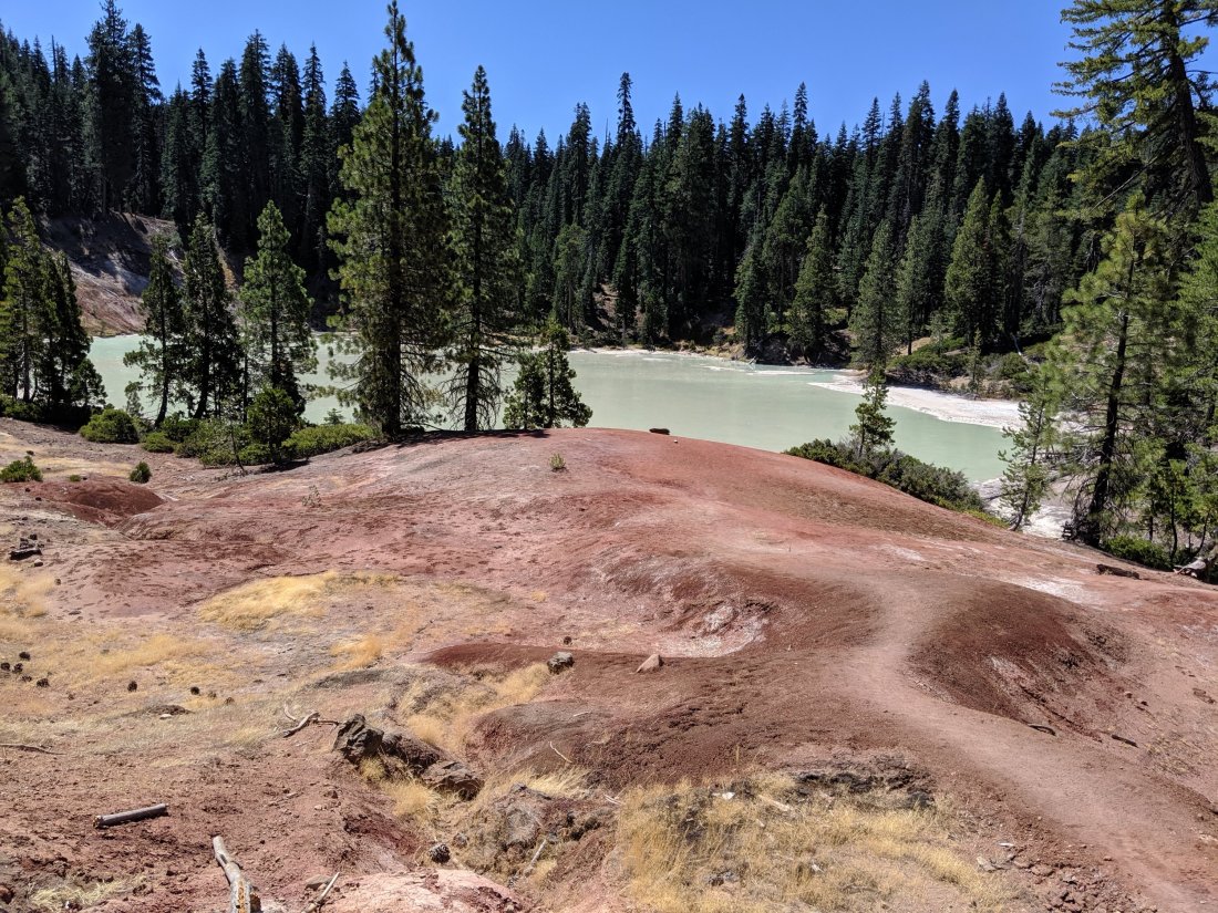
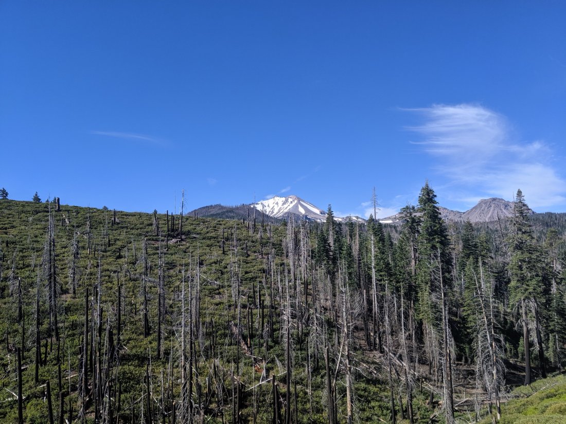
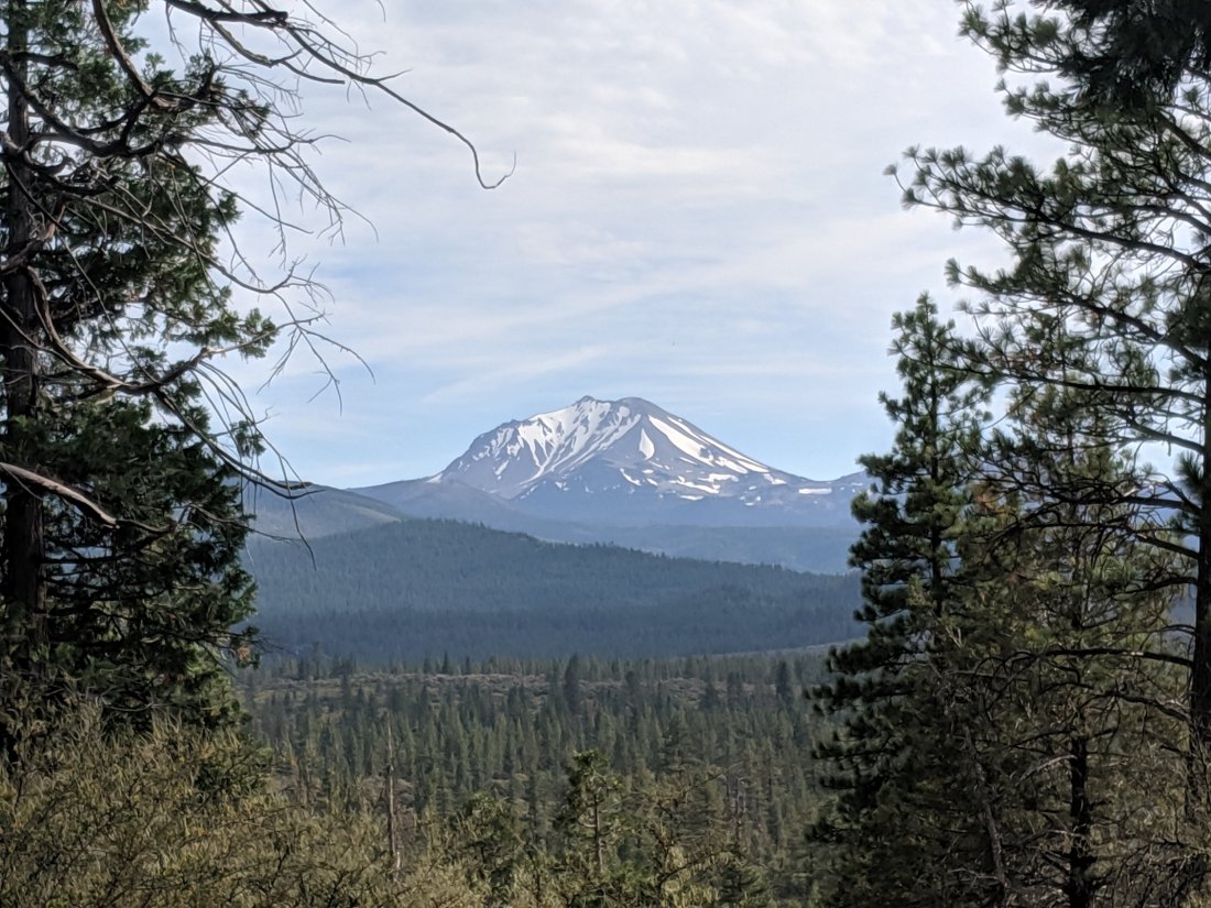
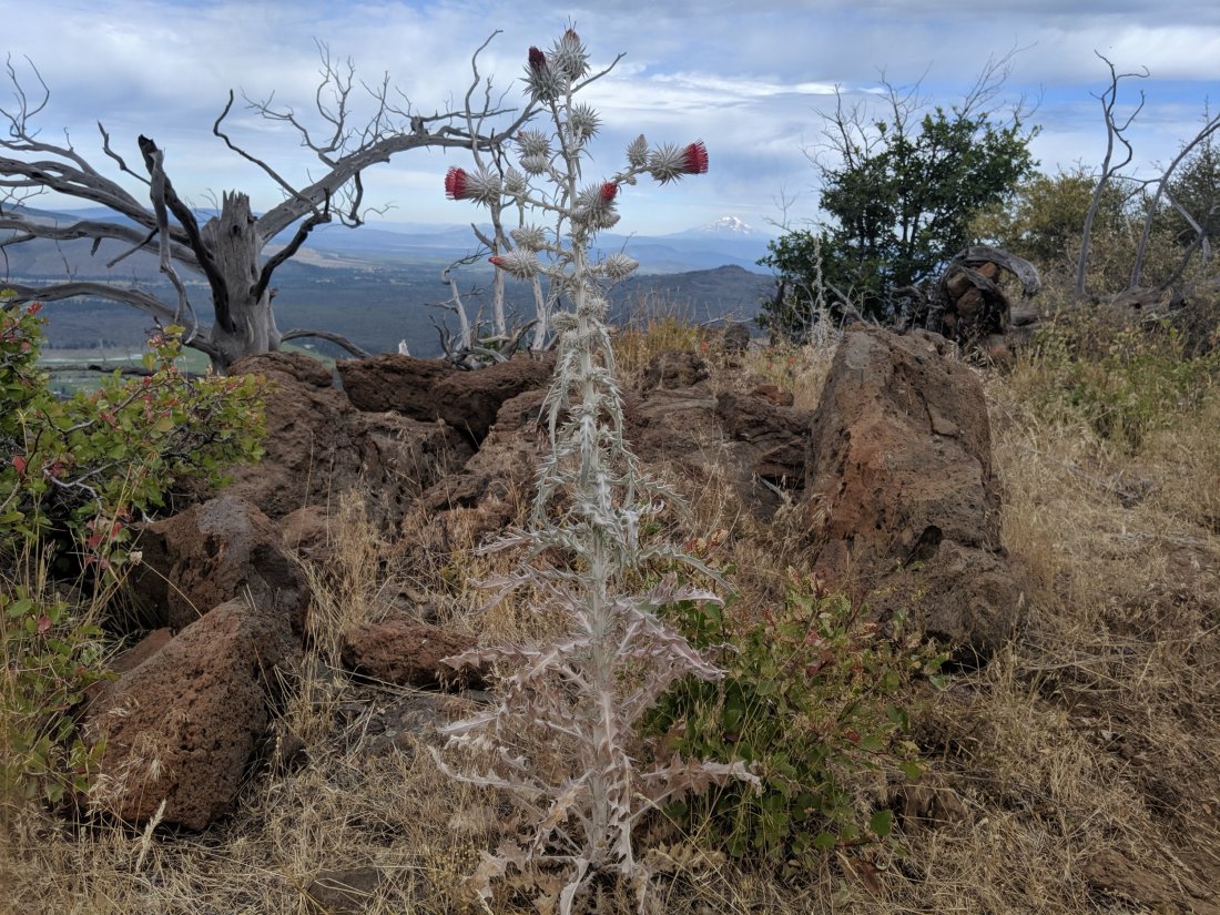
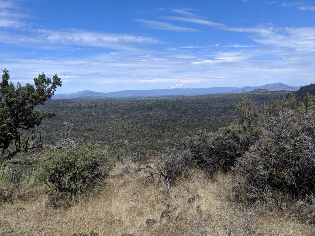
First, since leaving Donner Pass, the Sierras have gradually mellowed and died out as I moved north. While far from the largest, at c. 10,500 feet, Mt Lassen is the southernmost volcano of the Cascade range, where I will be for the remainder of the hike, and whose super-prominent volcanoes will dominate the landscape (as I write this, I’m already in the shadow of Mt Shasta, which, at 14,200 ft, is the second highest Cascade volcano, after Mt Rainier). It’s a nice psychological boost to move into a new range, and to be able to measure progress visually by which volcanoes are visible at any point.
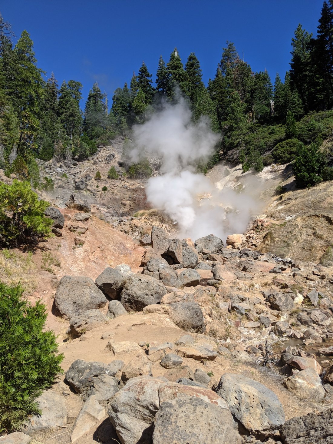
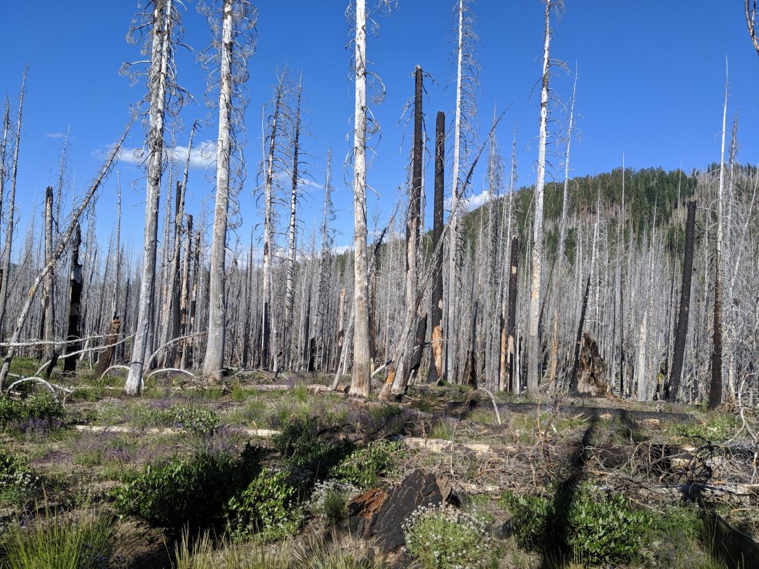
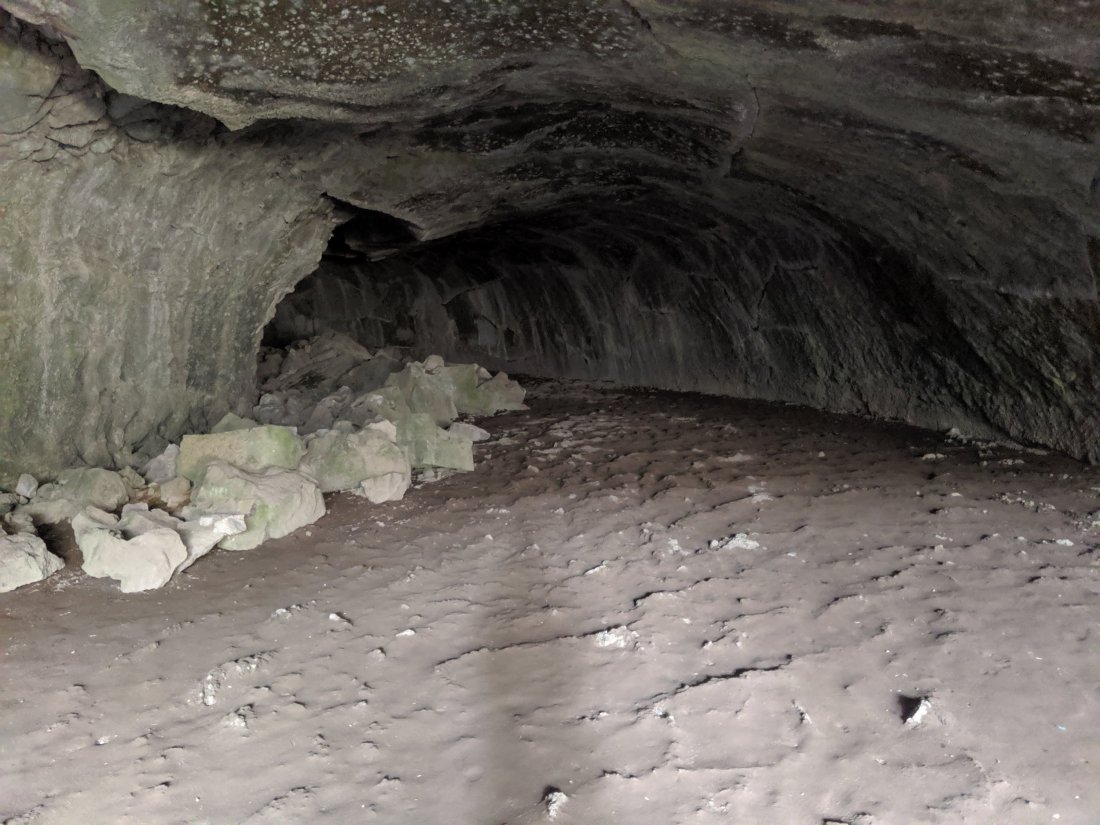
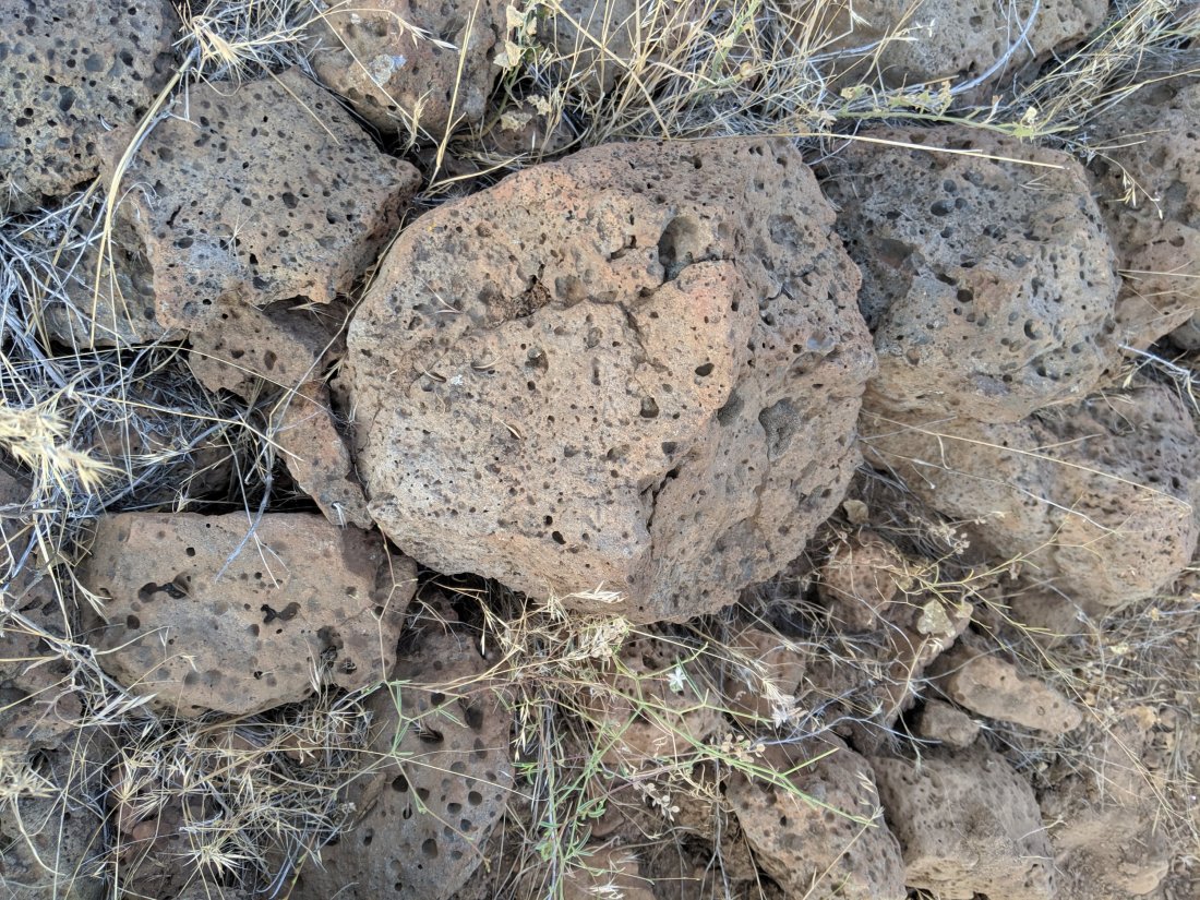
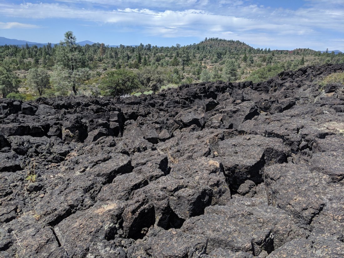
Second, the volcanic landscape is awesome, if a bit painful on the feet. Lassen is an active volcano, and erupted in devastating fashion in 1915. As a result, there are all sorts of active geysers and sulfuric expulsions, as well as lava tubes and hardened lava floes from older volcanic activity. Recent fire activity has also opened up the views, while making the hiking pretty toasty at times.
After Katya and Anya left, I pushed 25 miles through the moonscape to the town of Burney, where the local Assembly of God church has opened up their multipurpose room to hikers for free. I can’t say I agree philosophically with Assembly of God or other similar Evangelical Christian sects, but they’re very kind and generous here without trying to evangelize, and I really appreciate their hospitality. Now time to run a few errands around Burney and hit the trail towards Mt Shasta!
