
Day 13: Idyllwild (179 + 3 miles off-trail) to somewhere on the north face of San Jacinto Peak (193)Day 14: 193 to Whitewater Creek (219)Day 15: 219 to Mission Creek (232)Day 16: 232 to Arrastre Trail Camp (256)Day 17: 256 to Big Bear (266)Highlights: Walking alone through the snowy forests on San Jacinto is probably my favorite experience so far; My brother has joined for a week or so; Fun adventures route finding around Mission Creek.Lowlights: It wasn’t in the cards to make it to the summit of San Jacinto; Incessant heavy winds throughout Day 14 were really demoralizing; It’s still really cold.
Idyllwild into the San Jacintos
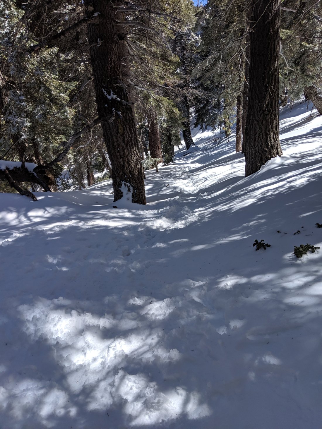
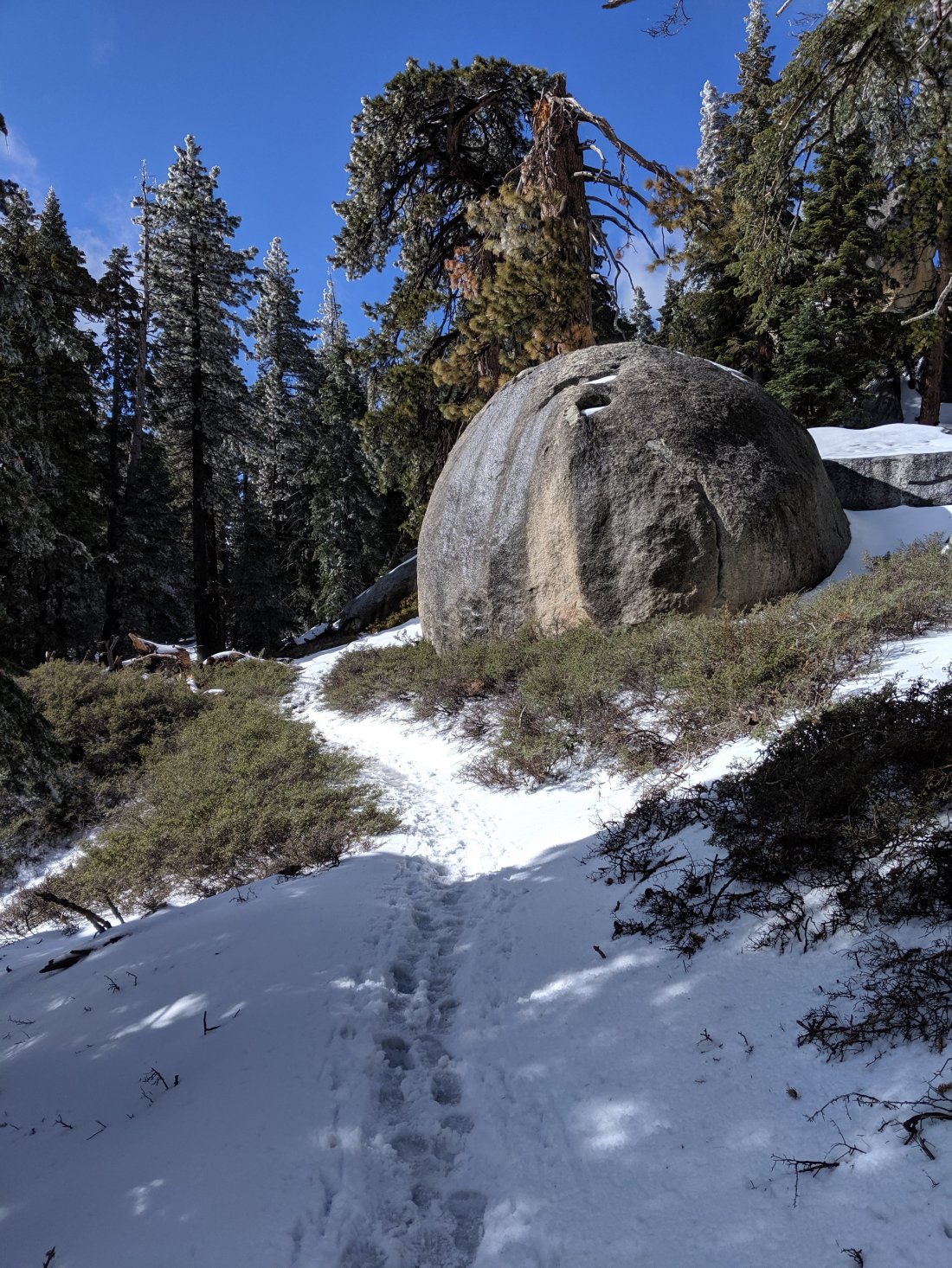
I got a late start on the morning of Day 13, as I had to wait for the post office to open and do a load of laundry (unrelated to the post office’s opening hours). After a hitch to the trailhead around 10:30, I was heading up the 2.5 mile/ 2,500 foot elevation gain Devil’s Slide trail to get back up to the PCT.There was fresh snow all the way down to the trailhead around 6,000 feet, so I knew it would be slow-going the whole way. Some very beautiful views of the two rock faces which make Idyllwild a hotbed for climbers: Tahquitz Rock and Suicide Rock. The former (and pictured first below) is where the Yosemite Decimal System for rating climbing difficulty (e.g. 5.10) was developed (though presumably it was popularized in Yosemite).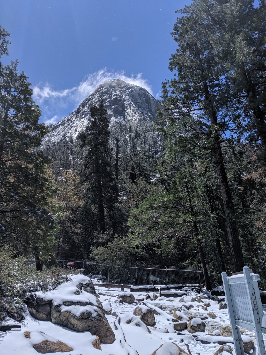 I had wanted to do the side trail up to the top of San Jacinto Peak (around 11,000 feet), but decided against it because: (1) I was alone; (2) I knew there would be a lot of snow up there which could mean slow going and possibly danger; and (3) I thought another storm was coming the next day, so wanted to make sure I made it below snow level that day. The next day I spoke to two young women who had done it without any supplemental equipment, and in retrospect it would have been nice to do it with them, but they left before the post office opened. Anyway, it was a bit disappointing not to be able to do it, since that would have been the highest point of hiking in Southern California, but ultimately I think I made a good decision to skip it.Aside from the ascent to the PCT, during which I was walking and chatting with a couple from Denver (yes, I reminded them to vote), I was alone for most of the day and only crossed paths with a handful of people. There was no wind, and the layer of snow meant there was no ambient noise behind my footsteps except the occasional bird chirping and flowing creek. That wintery sense of tranquility and solitude was incredible and possibly the highlight of the trip so far. And also super unexpected, considering I’m supposedly in the desert.
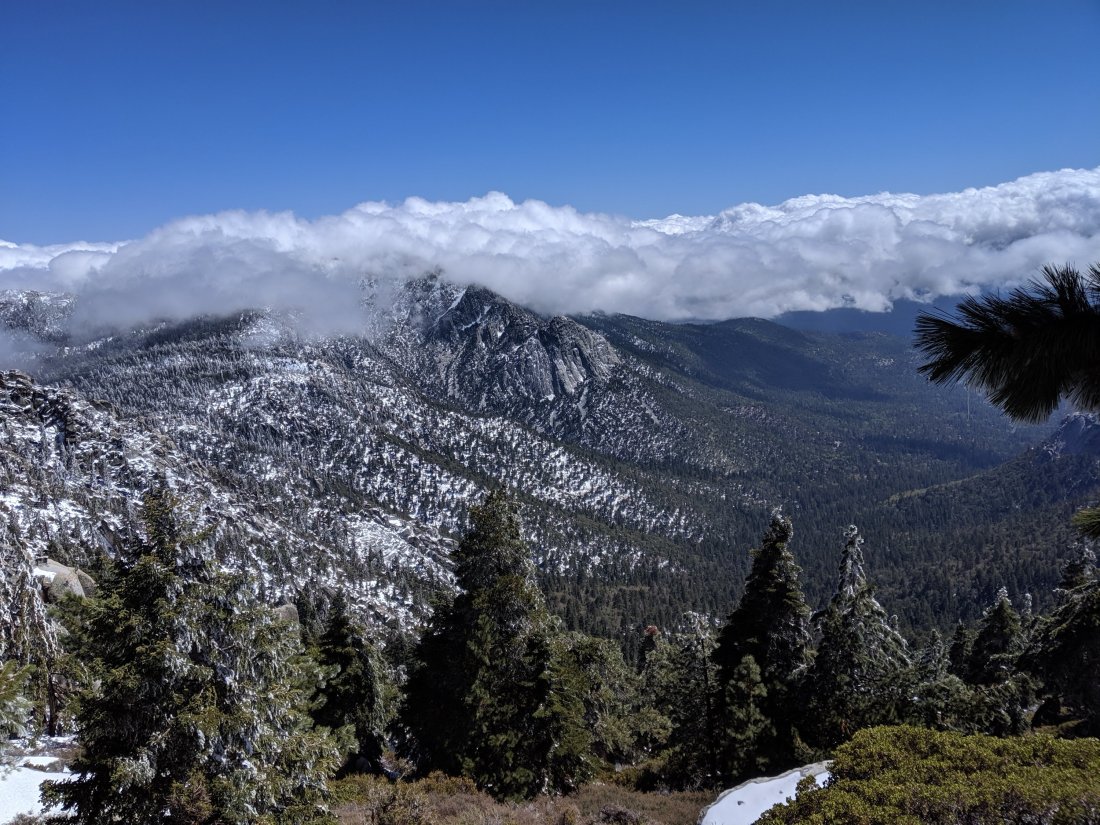
 The going was quite slow though, and I needed to do 15 miles or so before I would crest and start the long descent out of the mountains to the valley below. Fortunately, because of the snow cover I was able to cut straight across the switchbacks and had good fun glissading (i.e. boot-skiing) down some slopes which otherwise would have been a bit of a slog.I made it over the top (c. 8,500 feet) down to around 6,000 feet by about 9 pm, and set up my tent in preparation for a windy, rainy night. The precipitation never came, but my god it was windy, which made it pretty stressful to pack things up the next morning without a tent flying away.
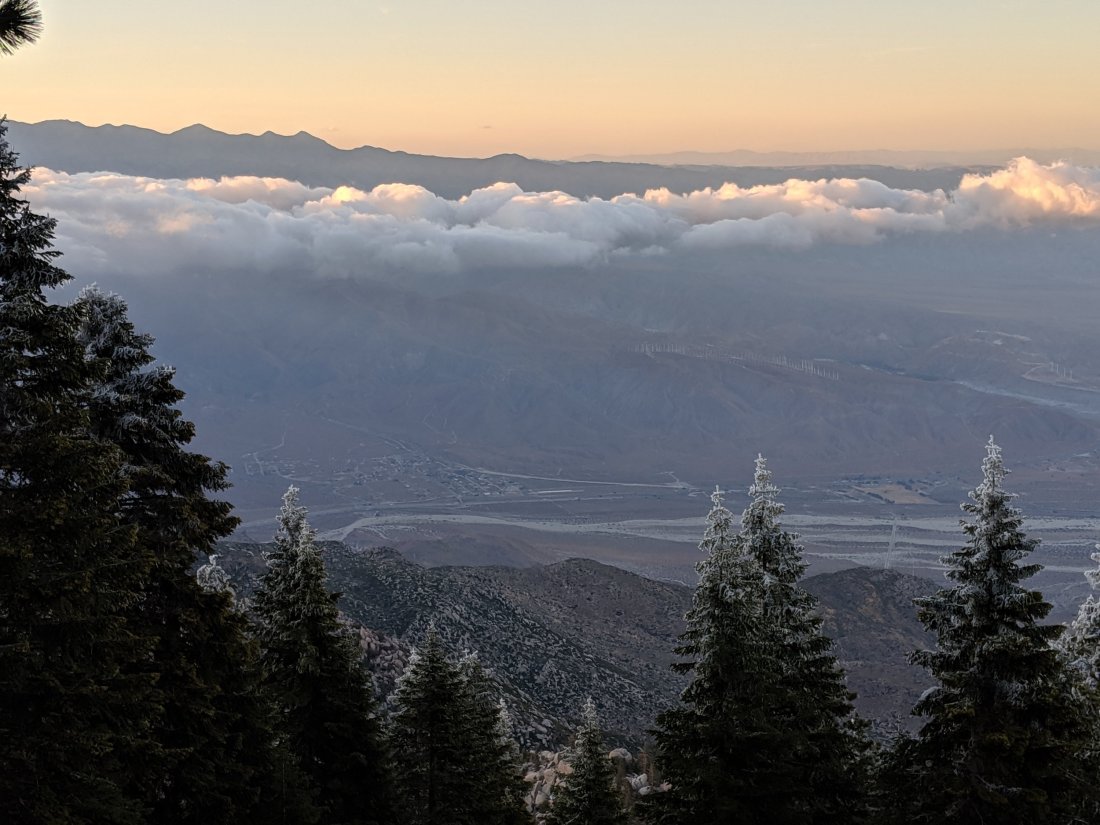
Out of the San Jacintos and into the Wind Tunnel
It’s a brutal descent out of the San Jacintos, dropping about 7,000 feet descent over 20 miles. The whole way you can see Interstate 10, the end of the descent, in the distance and never getting any closer.While it was kind of infuriating how slow the downhill progress was (trail could have been twice as steep and half as long), it was nonetheless cool to see so many changing ecosystems in a single day. I started in pine forests, and was soon back into desert scrublands.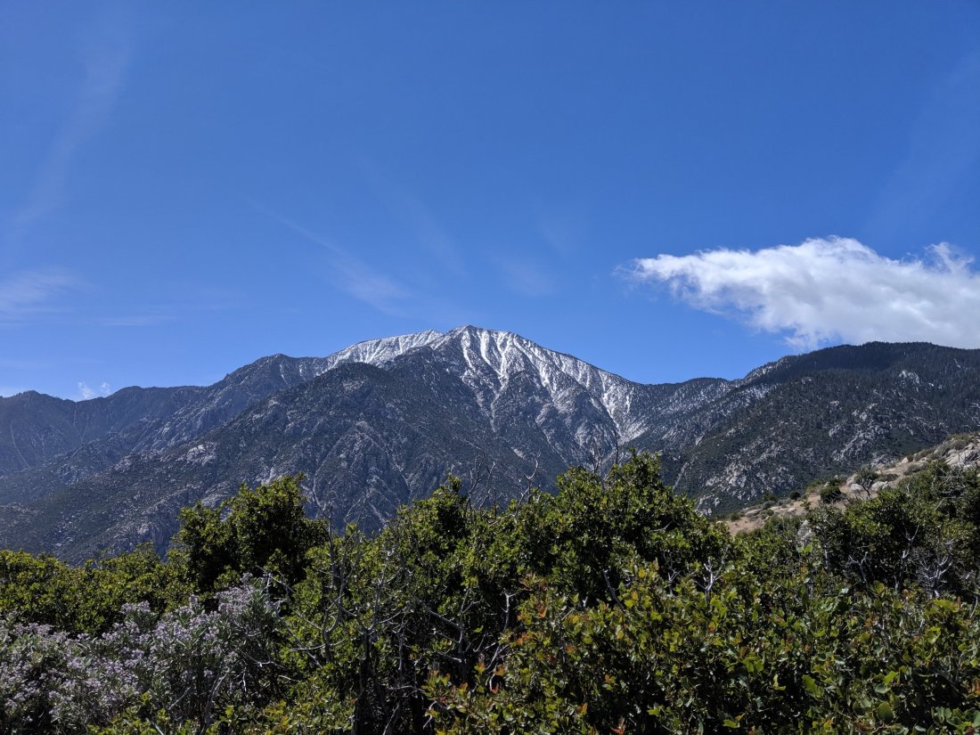


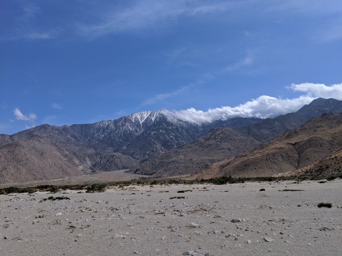 At the bottom, however, things got really windy and unpleasant. I had to walk roughly 3 miles across the flat from the base of the mountain to the crossing with I-10, which seems like it would be easy, but the winds were so strong that it was difficult to keep balance, let alone walk quickly. By the end, I was walking in sand, which made walking even more difficult and also meant that I was getting blasted with sand every couple of minutes. Now I know what a sandstorm feels like.I believe Southern California topography means that this area is always very windy, as cool ocean air rushes through the low passes into the inland deserts. Presumably that’s also why there are a bunch of wind farms there.
Wind Tunnel to Whitewater
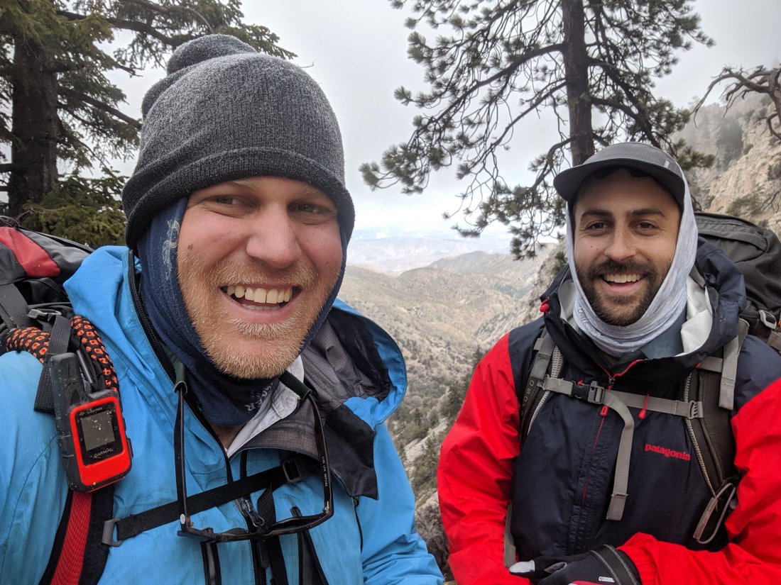
I got to the interstate around 4 on Day 14, where my brother Torsten was waiting for me to join for a week or so. Several other hikers around me were discouraged by all the wind and unfavorable weather forecast, and so went to go split a motel room in a highway town nearby. That seemed like a boring way to introduce Torsten to the trail, plus I theorized that the wind would be much better over the next hill (away from the low pass), so we pressed on for another 9 miles or so that evening.While those 9 miles were pretty miserable (I was tired, lots of wind and rain, big climb), my theory was correct, and when we dropped over the top of the hill, we were in this oasis of nice weather beside a really cool braided river called Whitewater (River or Creek?). The river flowed through various random little channels over a rocky plain of maybe a mile across, with a large sandstone feature in the background more reminiscent of the Colorado River Plateau than a mountain range. We camped there for the night.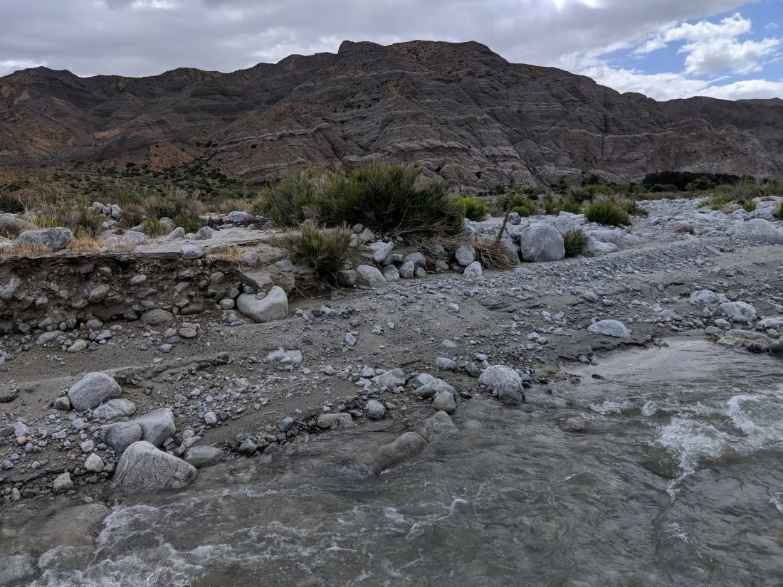
Rising into the San Bernadinos
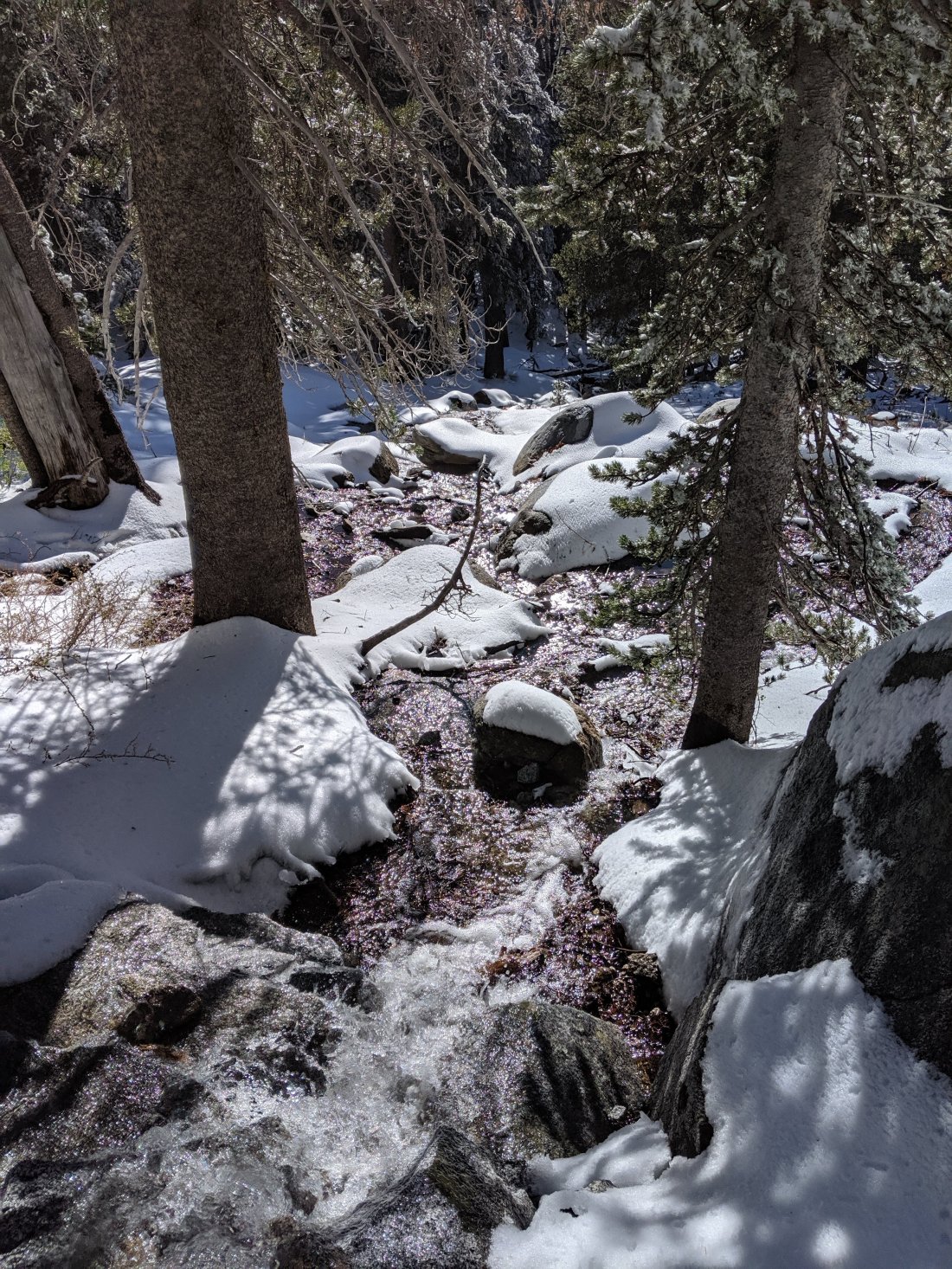
I was pretty exhausted from a 26 mile day and Torsten wasn’t quite into the hiking rhythm on his first morning, so we got quite a late start on Day 15, and were hiking by around 10:30.After crossing the Whitewater River and climbing a small hill, we soon descended into Mission Creek, another braided stream flowing south out of the San Bernadinos. The trail then follows this creek 14 miles up to its source, gaining around 5,000 feet in the process. Given prospects of poor weather the next morning, we decided to tackle only the first six miles of the ascent on Day 15, so that we wouldn’t be above 8,000 feet when the bad weather was supposed to hit.The ascent up the river, split better an afternoon and a morning, was full of adventure and slow going. I think heavy rains over the winter washed out much of the trail, so we had to do a lot of route finding and river crossings/fordings to navigate our way up the canyon.
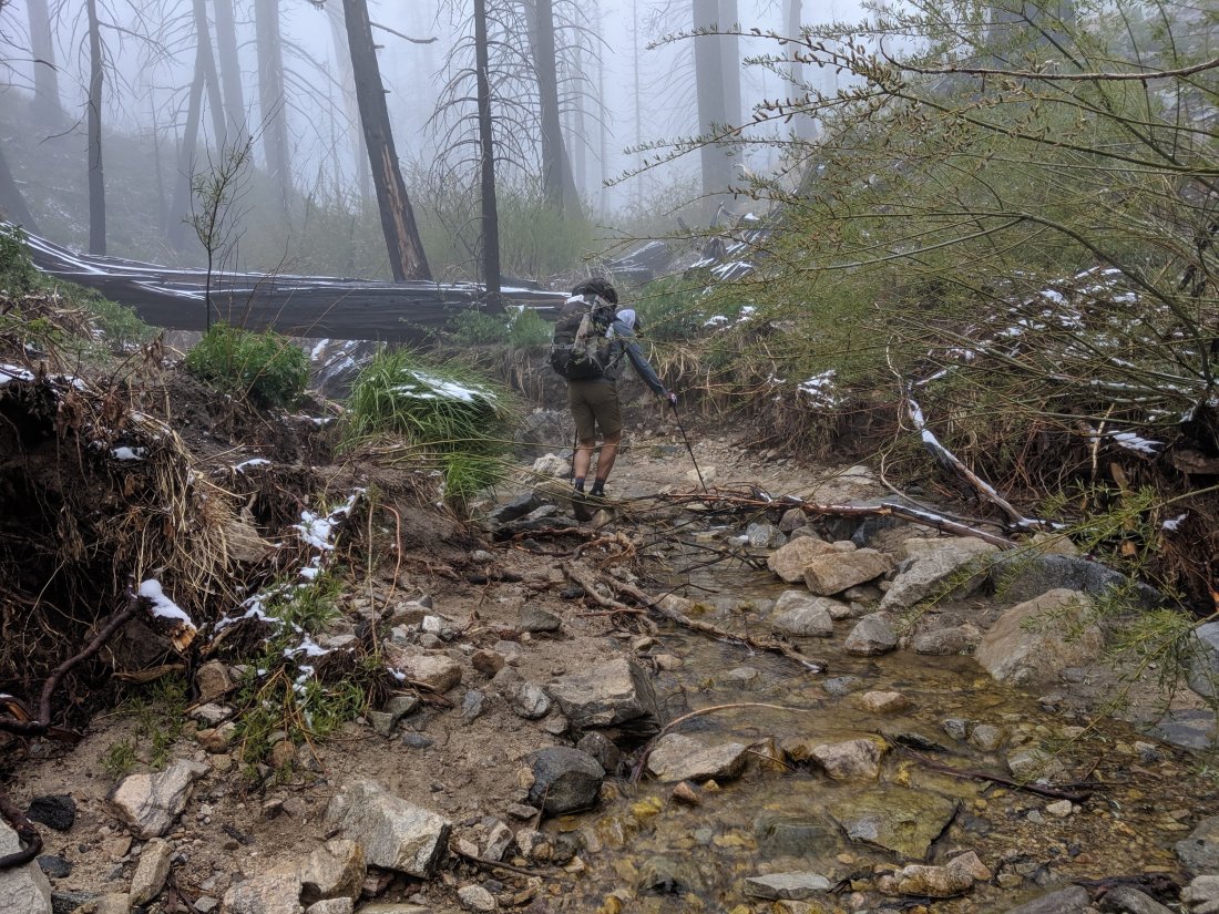 In the upper reaches of the canyon, the weather got foggy and misty, and the flora less desert-like.
 We crossed out of that drainage in the morning of Day 16, and continued through the San Bernadinos. While visibility was highly limited for most of the day, we were mostly in pine forests on the tops of ridges for the rest of the day, all between 8,000 and 9,000 feet.We decided to push for a 24 mile day so that we could camp below 8,000 and so we could make it to Big Bear by lunch the next day, so we had a few long stretches of intense, head-down hiking.By the late afternoon, the clouds lifted, and I could finally get some decent pictures.
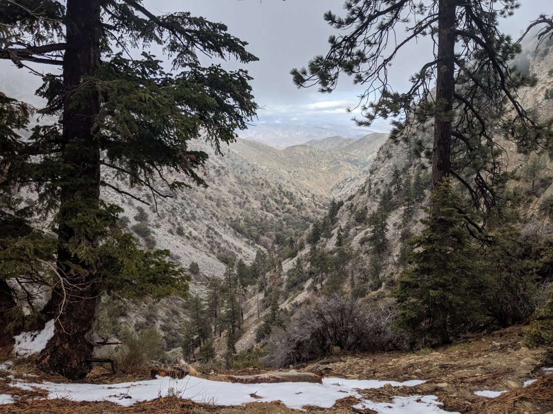
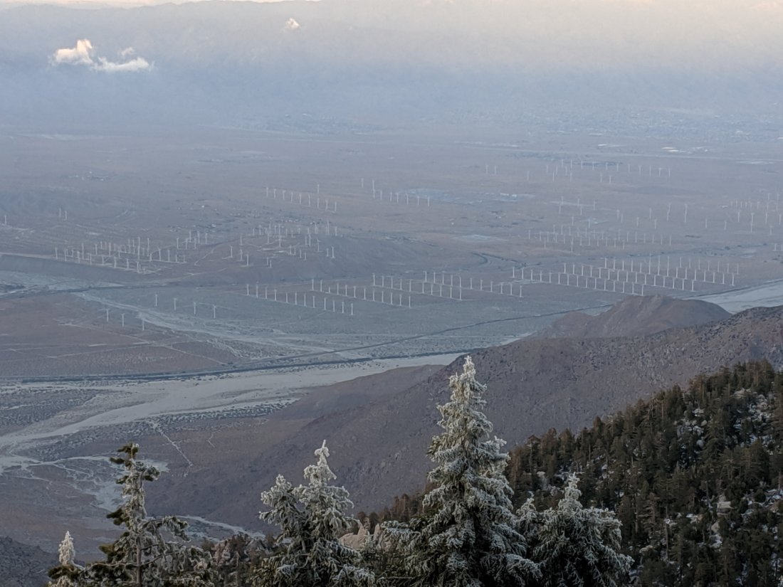
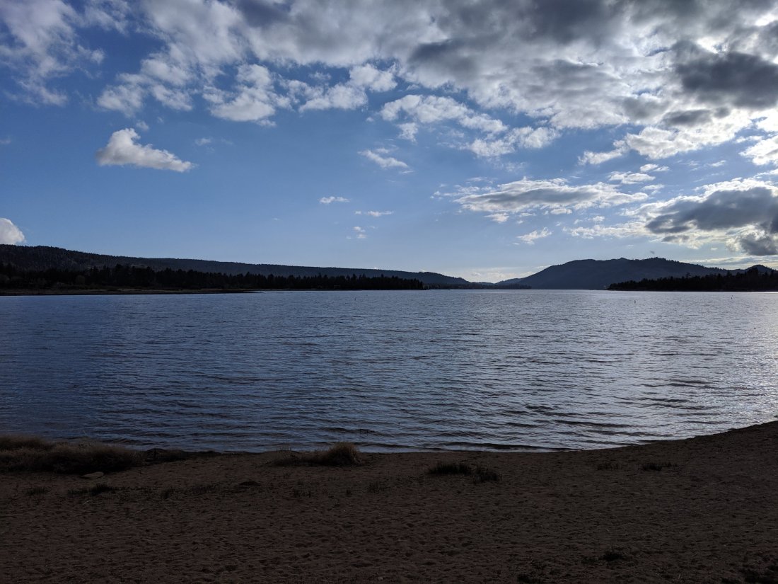
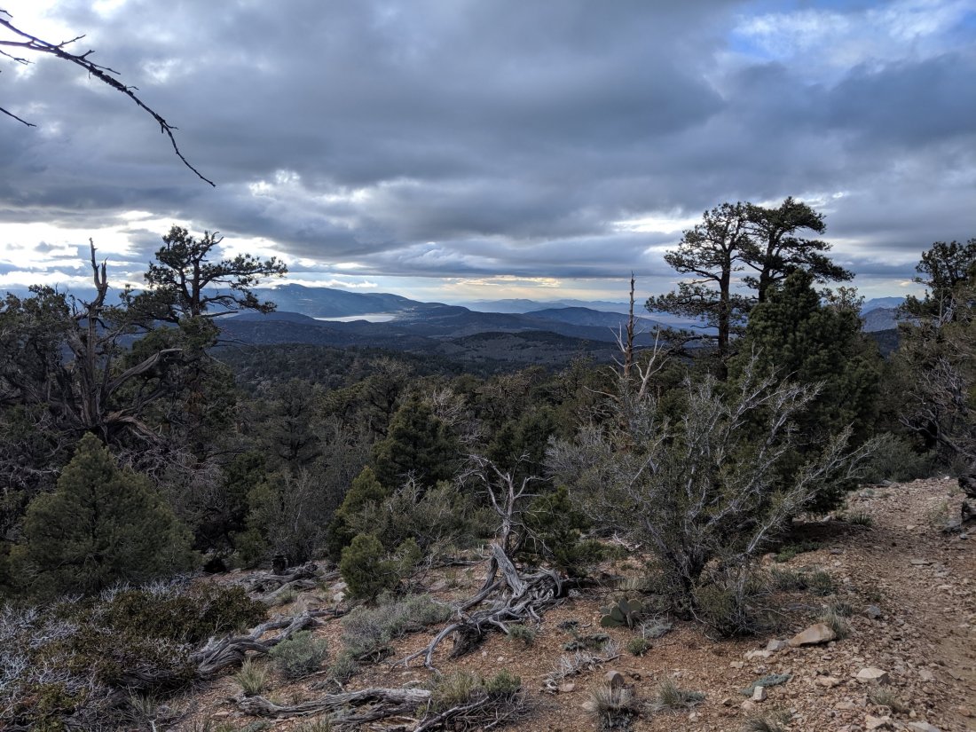 We ended the day on a long downhill into Arrastre Trail Camp, about 10 miles before the road to hitch into Big Bear.10 easy miles later we were in Big Bear. Awesome views over the northern escarpment of the San Bernadinos into the Mojave Desert.
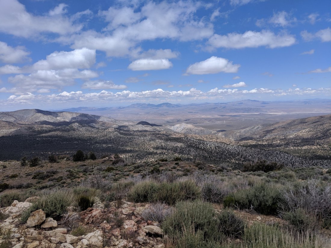

Amazing! Thanks for sharing!
LikeLike
Moving right along! Glad the snow hasn’t been much of a problem (yet…). Enjoy the time with Torsten. You will both remember it always.
LikeLike