Day 60: Donner Pass/Sugar Bowl (1153) to backside of Squaw Valley (1140)
Day 61: 1140 to Richardson Lake (1119)
Day 62: 1119 to Echo Summit/South Lake Tahoe (1091)
Day 63: 1091 to Showers Lake (1082)
Day 64: 1082 to the side of Raymond Peak (1059)
Day 65: 1059 to the side of Arnot Peak (1038)
Day 66: 1038 to Sonora Pass (1017)
Highlights: Meeting lots of interesting people; great trail magic; Desolation Wilderness; familiar territory at first; back to knocking off 20+ miles/day.
Lowlights: More snow than I expected; Losing my hiking partner; everyone I meet is either a dayhiker or northbound, so difficult to build meaningful relationships; psychological challenges associated with now walking away from Canada.
I’m not going to write this post as a day by day account, in part because I’ve got seven days’ worth of material to cover, and also because there are several common themes that thread each of the days together.
Overall Hike Description
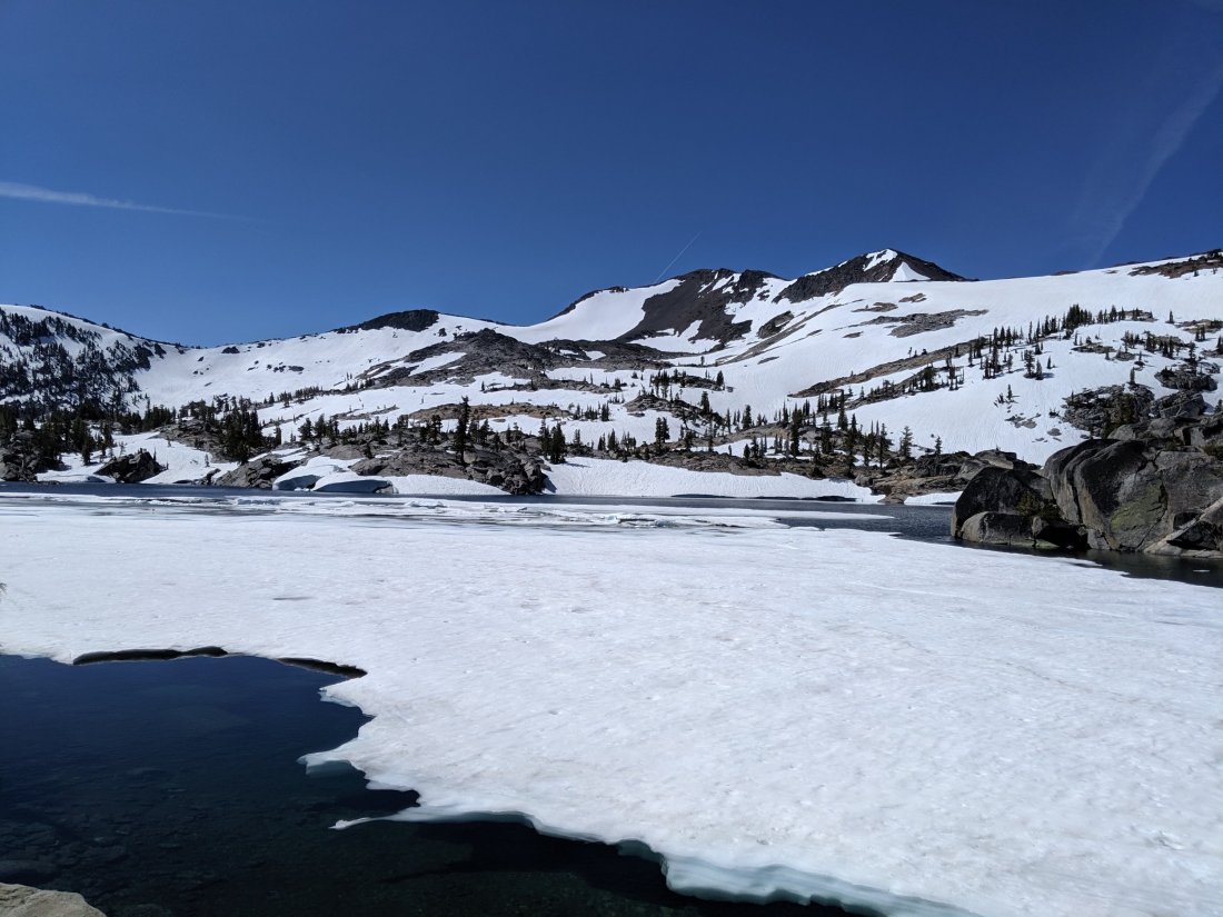
This section is basically the populated northern Sierras: there are roads crossing the mountains (I’ve reached Donner, Echo, Carson, Ebbetts, and Sonora Passes), ski resorts, and day hikers (as well as hikers of the 150ish mile Tahoe Rim Trail). The mountains are less dramatic than where I bailed from, but it is still a very mountainous region, and there’s not really much less snow than much further south.
There are two big differences in hiking conditions, however: (1) the snow tends to be in shaded, often flat, areas and can be difficult to predict just by looking at a map (as opposed to the High Sierra, where the snow line was above the tree line, and therefore more predictably accumulated at higher elevations and northern exposures); (2) because the snow is in wooded areas, it feels quite a lot less precarious.
Anyway, there’s enough dry trail that it’s possible to hike more than 20 miles in a day, but enough snow that it will take all day to do so, and your pace may be stymied by an unexpected snowy patch.
Losing Jordan
This heading is more ominous than it should be: Jordan is doing fine, and is simply now heading north, and will return for the Sierras after reaching Canada. With that disclaimer out of the way, there was more snow than either of us expected, and we were both surprised as to how difficult it was to do the miles we thought we should be doing.
We obviously reacted to that situation in different ways though: while Jordan is a stronger hiker than me overall, I am evidently much more comfortable on snow than me, perhaps due to being on skis not long after I could walk, or the countless winter and late spring trips into Salmon Lake. While he grew quickly frustrated at the slower pace imposed by the snowpack, I saw it as a fun challenge in my adventure. We ascended and descended several snowy slopes that he found sketchy, but that I thought were reasonable.
On our second night out of Donner Pass, Jordan told me that there was a good chance he’d make it to South Lake Tahoe and then head right back to Truckee and start going north where the snow would quickly cease to be a factor. I had set out with a partner back into the Sierras for safety reasons, so I had to figure out what I would do if he chose not to continue.
One advantage of hiking southbound is that you cross paths with every northbound hiker, roughly 4-5 every hour. I’d asked several what to expect, and I gleaned that the trail conditions didn’t worsen between where we were and Sonora Pass (i.e. the distance covered by this post), and that the toughest part was probably Dick’s Pass in Desolation Wilderness, which we were about to summit. Therefore, I resolved that if I were comfortable doing Dick’s Pass alone, then I would continue alone at least as far as Sonora Pass should Jordan bail.
I didn’t have to imagine what doing Dick’s Pass alone would be like. After crossing a snowy approach, we began to climb the pass in earnest. The trail up the slope was dry at first, but soon comprised several snowy traverses. I traversed most of these while Jordan climbed below them on dry, but steep, ground. The last traverse was the longest, sketchiest (but manageable in my opinion), and unavoidable. I went up it first, and turned around 10-15 meters up to tell Jordan that he should probably have his ice axe out for it. He replied that he wasn’t going to do it and was going back the way he came.
So that was that. I didn’t think the conditions necessitated bailing, so we shouted each other well wishes (while the slope was manageable, I didn’t really want to go down and back up it), and went our separate ways. If we both stick to our planned hiking itineraries, our paths won’t cross on trail, but hopefully I’ll see him somewhere in the world before long.
It’s a bit disappointing to be alone now, but ultimately we had different strengths and objectives. For me, finishing on the Canadian border with limited disruption to the south-north footpath is important, and I don’t mind dealing with snow on the way; for him, he wants to do every mile of the PCT as quickly as possible, but doesn’t care much about the order. I must also add that I commend his forthright attitude to bailing and not putting on any additional pressure on himself to continue where he wasn’t comfortable.
So now I’ve been alone for the last several days. In reality, it’s not been any more dangerous as a result, because there haven’t been any sizeable river crossings, and the steady stream of northbound hikers means I could wait for help if I needed it. I will most likely continue on this basis into the High Sierra, unless I can find some partners at Sonora Pass (Kennedy Meadows North). For the final section of the Sierra, south of Yosemite, I’ll be overlapping with John Muir Trail hikers, who mostly go southbound, so I should have company for the high passes.
Meeting Interesting People
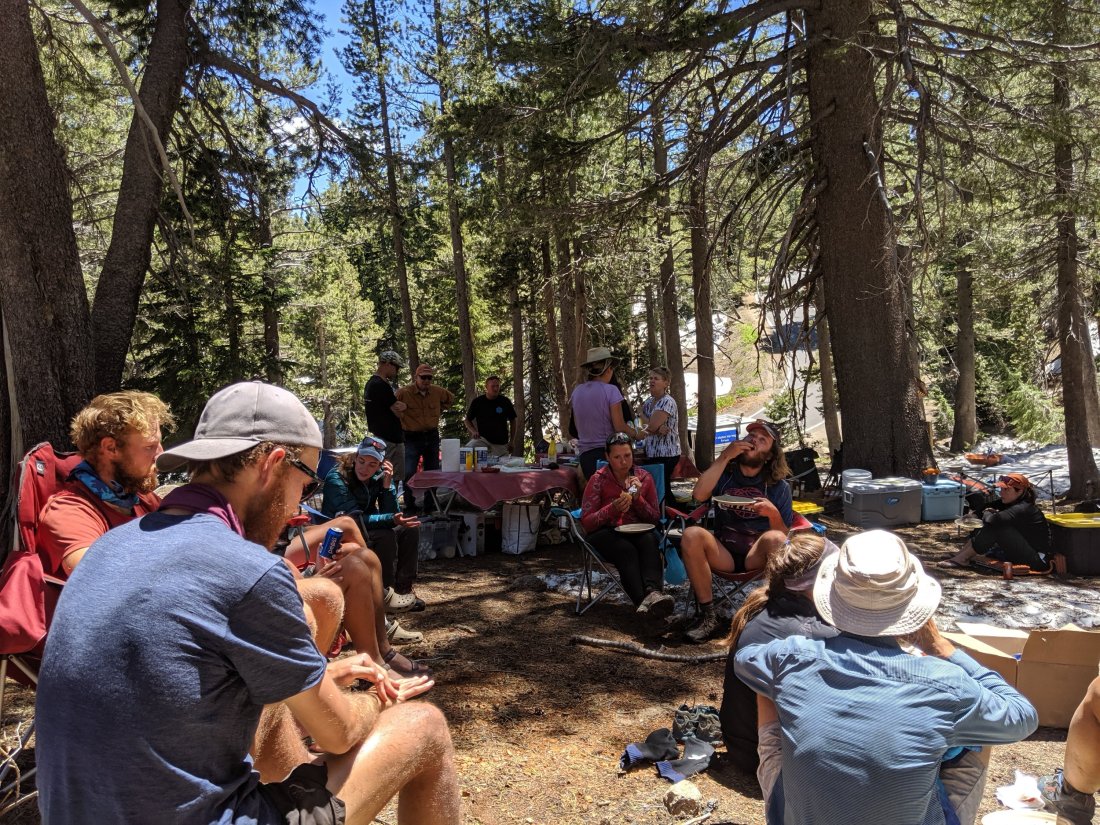
As I’ve referred to above, I’ve crossed paths with a lot of people in the last few days, more so than at any other point of the trail. Most of these are northbound PCT hikers, which means they entered the Sierra a couple weeks earlier than I did and are therefore pretty badass. Within the next two or three days, I expect to start crossing paths with people I know from further south, which will be awesome but will also slow progress as I stop and catch up with each of them.
Some of these folks are pretty cool. Two that stand out weren’t actually PCT hikers, but rather a mother and her 12 (?) year old daughter, who have gone out on an annual backpacking trip for the last several years. They only do about 2-3 miles a day at this point, but when I asked the daughter if she was going to do the PCT one day, she nodded so quickly and forcefully that you’d think I asked if she wanted marshmallows (incidentally, they had a campfire and I had marshmallows, so that was also a question I had asked).
This section also had some awesome trail magic at the road crossings.
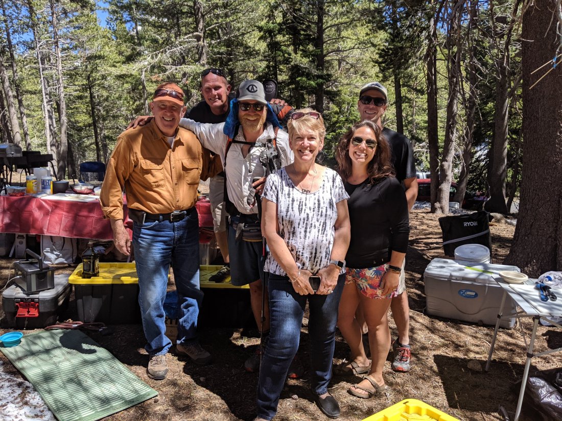
At Carson Pass (Highway 88, just east of Kirkwood), some volunteers were running drinks and snacks out of the ranger station. The ranger station was also open and full of the local history of Carson Pass and Kit Carson, John Frémont’s scout for whom it was named. The local ranger (sadly not present) is also apparently a Sierra history buff, and authored a book about one of my dad’s favorite Sierran heroed, John “Snowshoe” Thompson, a Norwegian immigrant in the 19th century who kept the mail going through the winter by skiing over the snow (the locals, having never seen this Norwegian concept before, called them snowshoes).
And then at Ebbetts Pass, a group of several volunteers organized a full-on barbecue, complete with side dishes and desserts. One volunteer recognized my UC Davis trucker hat (which requires some local knowledge, since the logo is a C with an A inside it). Turns out she’s from Davis and graduated DHS a year before me. For any Davisites reading this, her name is Morgan Miller, and I feel like I probably knew who she was at the time, but have since forgotten.
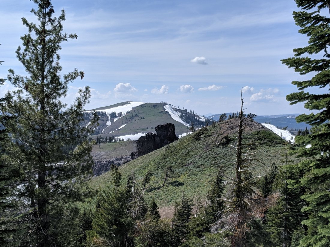
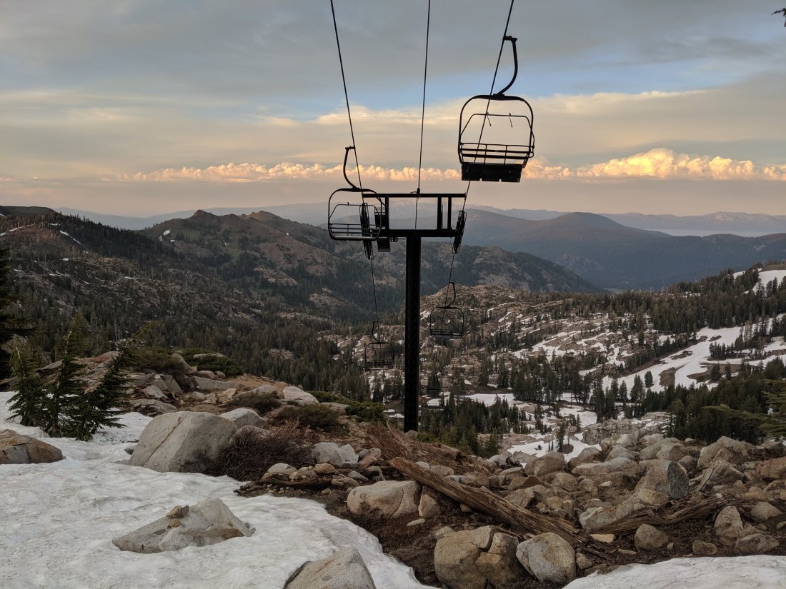
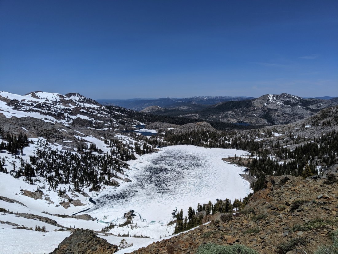
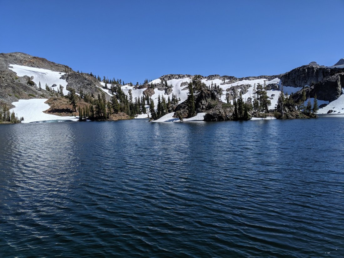
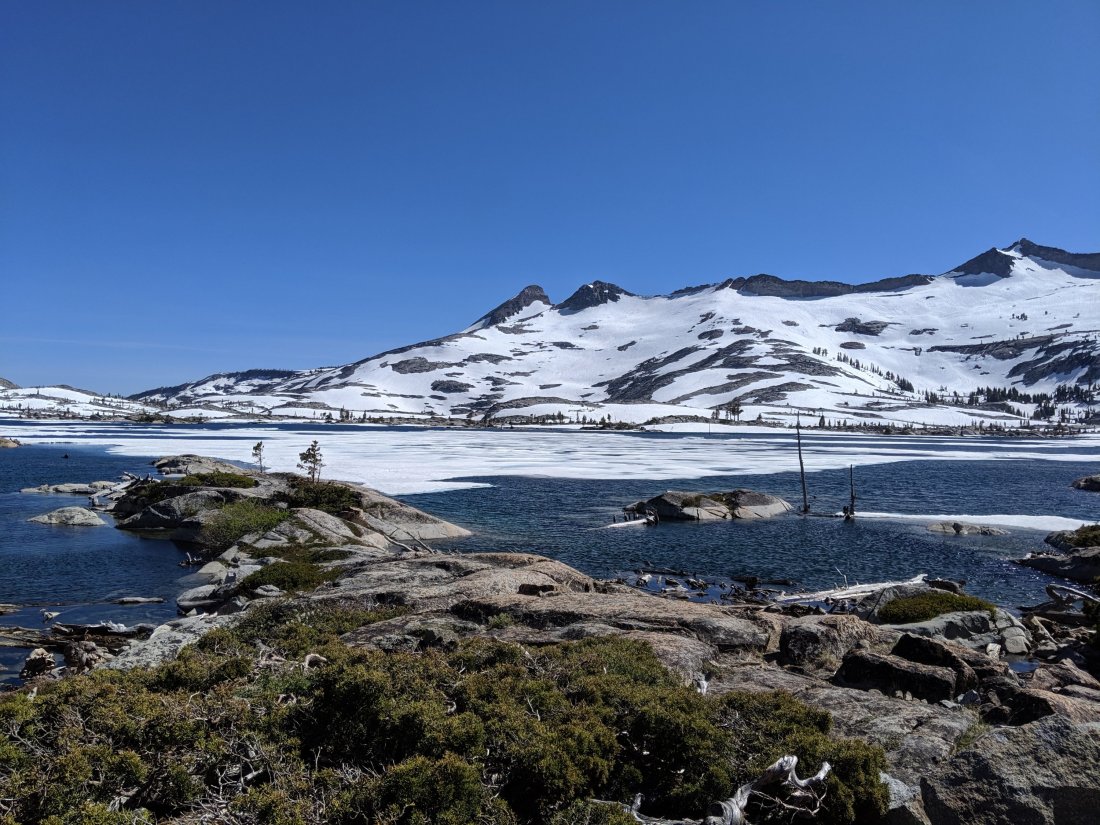
Desolation Wilderness
A big highlight of this section is Desolation Wilderness, just southwest of Lake Tahoe. Several friends have gone backpacking there, so I knew it was awesome, but had never been there myself. And it is indeed awesome. With lots of picturesque lakes and snowy slopes, it reminded me of the High Sierra I’d just left, albeit with a few more trees. What’s amazing is that it’s right next to Lake Tahoe, between Interstate 80 and Highway 50, by far the most developed part of the Sierras. And it’s a world away from all of that. If you’re planning a 2-3 day backpacking trip in northern California, allow me to put my vote in for Desolation Wilderness.
Pictures tell a thousand words (each), so here’s 5,000 words of imagery.

Psychological Challenges
In addition to the physical challenge of pushing bigger miles in snow, the biggest challenge for me has been psychological. After spending nearly two months moving slowly but surely towards Canada, around a fairly consistent set of people, that has all been thrown out the window by driving north and hiking south.
It’s difficult never seeing the same person twice, but the main issue is that I feel this big discontinuity in my hike at the moment. For example, I will cross the 1,000 mile marker at some point tomorrow, which is obviously a huge milestone. Except that at that point, I won’t have done 1,000 – I’ll actually have done about 955 PCT miles. And even if I had done 1,000, it won’t have been *those* 1,000 miles, so I’ll feel weird celebrating it.
While I don’t regret flipping north, and I probably won’t remember this feeling after the hike, this pending discontinuity bothers me at the moment, and I feel like doing the Sierra now is a necessary chore to resolve it rather than an integral part of my journey.
I also find myself focusing more on the finish line of this discontinuity than is probably healthy, which makes it more difficult to focus on the beauty around me at present. And that’s a shame because this is one of the world’s most beautiful stretches of trail. As I push into the next sections, I’ll try to focus on enjoying the journey at hand and less about getting back northbound to Canada. If, looking back on it, I find that mental element fundamentally dampened my enjoyment of it, I may wish to hike the John Muir Trail one day down the line, which follows almost the exact same route but without the time pressures.

Beautifully written!
LikeLike